Fall Colors on West White Pine Mountain

October 1, 2011 at 2:02 pm

This post is coming, ummm, three months late? I should probably just admit it to myself: real life is killing my blog.

Aspens on fire

And when it comes to sharing photos and little write-ups about our trips, Facebook seems to be the easiest place to do it these days. But, some hikes we do (like this one) are just so nice, that I’d like to put them out on the interwebs for everybody to enjoy.

Ready to get walking after a long car ride

So, last October, Mark and I packed up the family and went for an afternoon hike at our favorite spot to view fall colors in Colorado: West White Pine Mountain road. This is a 1.5 mile hike to a saddle and on to the summit of a local little peak. The “trail” is really a 4×4 road and we were passed by probably nearly a dozen trucks and jeeps driving up and down the steep, rocky road that afternoon.

Mark, G and Liv hiking up the hill

View from the mountainside

I think we hit the peak of local color just right. There were quite a few green leaves still hanging around, but they were absolutely out numbered by shining, golden aspens.

G spent the whole hike up the mountain in Mark’s backpack going “Ooooh woooow! Ooooh woooow!” Granted, those are two of the only 5 or so words that he knew how to say at the time, but I think he genuinely enjoyed the bright yellow trees and an afternoon in the mountains.

G enjoying the ride

As we all did!

Kate and G enjoy an afternoon snack

Walking the Steamboat Hot Springs

September 14, 2011 at 11:54 am

It is estimated that there are nearly 150 hot springs in Steamboat Springs. The area is perforated with spouts of hot, bubbling water, seeping up from deep below the surface of the earth. In the 1800’s, these warm springs drew travelers from all over, who bathed in and enjoyed the unique “flavor” of each spring. There are seven or eight springs in downtown Steamboat that have interesting historical significance, and a suggested walking tour that takes you to each one.

Map of the suggested tour route

The tour, technically, begins at Heart Spring, which is the warm water source for the municipal hot springs complex on the south end of downtown. Early in the week, Mark, Bruce, G and I all went for an afternoon swim at the Old Town Hot Springs. It looked like an incredible facility, but because of the lull between seasons, they were cleaning out most of the pools when we stopped in.

So, we started our walking tour at Spring #2 – Iron Spring. Which was a very non-picturesque algae-filled cistern on the north side of town. According to Colorado’s Hot Springs, this icky pool of irony water was considered a tonic for “ailments of body and will.”

Our starting point, Iron Spring, was not very pretty

The third spring was Soda Spring. Once a very popular spot for making lemonade with the naturally carbonated water, but local highway construction disrupted the water’s flow. Now, it’s a nice gazebo, with a hole in the middle of the floor and a commemorative sign.

Soda Spring is historic, but now just a hole in concrete

Down the grassy knoll just outside the gazebo, we finally found some pretty springs in a more natural state. Hot Sulfur spring smelled strongly, but warm, light blue water bubbled up into a pool surrounded by white-coated rocks and grasses. The water ran out of the rock-rimmed pool and down into the nearby Yampa river, leaving a white-sulfur caked trail in its wake.

Sulphur Springs is beautiful, with a powerful odor

A short walk across the river landed us on the shores of Black Sulfur Spring. I thought this one was really cool. The water is actually black. It’s not tarry or muddy or much thicker than normal water. Just completely opaque.

Black Sulphur spring was dark and menacing

And right next door to that one is the town’s namesake – Steamboat Spring. The clear blue water in this one was such a gorgeous color, it was the prettiest spring so far.

Steamboat Springs - the town's namesake

From Colorado’s Hot Springs again:

“That spring and the town were named by three French trappers in the 1820s who had wandered up the Yampa River and heard a throaty, periodic chug. After months in the wilderness, they concluded that they’d hit a major river with paddle-wheel steamboats. … Later, geologists explained that the chugging sound was created when the superheated water and steam hit an underground rock chamber. The flows were compressed until the buildup forced the steam out with a chug.”

Unfortunately, the bedrock in the area was disturbed when the railroad was built nearby, and the chugging stopped in 1908.

Steamboat Springs

We all scrambled down the rocky shore of the river for a bit to find Terrace Springs, which flowed out of a marbled rock cave, over a large mineral formation and down into the Yampa River.

Terrace Springs makes a cool little waterfall

After this one, we all decided to skip Lithia Spring (“Lithia as in lithium, used in a mood-leveling drug and considered highly effective for manic depression.”) and hike up the hill to find Cave Spring. After nearly 45 minutes of wandering the steep hillside, and never finding more than wiffs of distant sulfur, we gave up and hiked back to town for lunch. It was a fun day, and we all learned a lot. We learned about the history of the town, the geology of hot springs, and that we should carry more water and sunscreen with us, even on short, in-town, walks.

Mark and G above Steamboat

Fishcreek Falls

September 12, 2011 at 8:53 pm

Our week in Steamboat Springs with Mark’s family coincided perfectly with the last week of summer. The leaves were not, quite, changing yet, but the smell and feel of fall was in the air.

G, Mark and Bruce

We hiked out to Fishcreek Falls on our first full day in the area. The parking area was covered in signs saying the area was closed for “tree spraying,” but the lot was full of cars and people were coming and going on both trails.

Fishcreek Falls

We walked out to the overlook, taking numerous shots of the falls along the way. I worried at the last overlook that I could smell wiffs of insecticide, and being the neurotic mom that I am, I suggested we head home and come back later in the week.

Fishcreek Falls

(The above shot is my favorite of the whole set. In fact, I think its one of my favorite photos from the last few years.)

Later in the week, we did come back. We walked the quarter mile down to a historic bridge over Fish Creek, and enjoyed the view of the falls from below.

Fishcreek Falls

Kathy even scrambled out on the rocks with me while I used my awesome new neutral density filter to shoot the falls, the creek, and anything near by.

Cataract in the stream

It is such a pretty area. I’m so glad we had a chance to share it with the family.

Mark, G and Kate on the trail

Jeff and Kathy enjoying a fall day

Camping and Hiking near Acorn Creek

August 27, 2011 at 1:33 pm

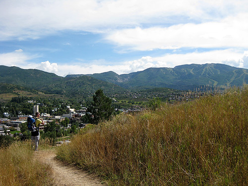
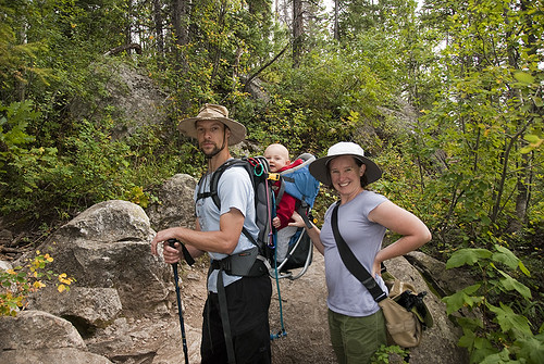
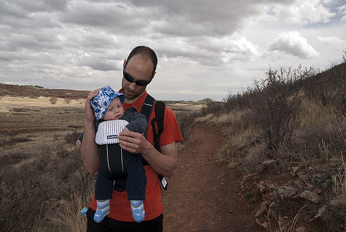
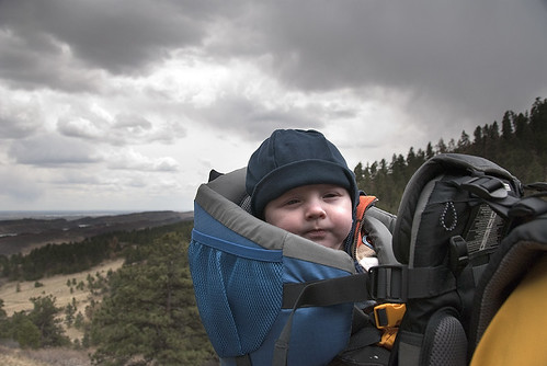
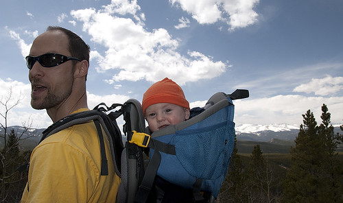
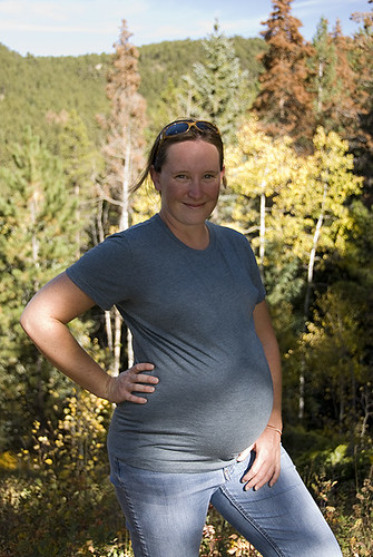
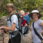
It’s 9am, and my pants are drenched from mid-thigh down. I’m trudging through a field of grass and wildflowers that are higher than my waist, and soaking wet. There’s a trail down there somewhere, but mostly I follow Mark, who has G (sound asleep) in the backpack and doesn’t seem to be bothered at all by the moisture or lack of trail or 60 degree slope of the hill.

How did I get here?

Sitting in a field of wildflowers

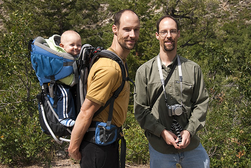
The answer to this question isn’t as simple as our usual “Hey, let’s go camping!” reason for getting out. This story starts with Mark’s friend from work, John, who is a bow hunter. It’s opening weekend for Elk via archery in Colorado, and Mark suggests that we follow John up to his hunting grounds. John will hike into the backcountry, with his wife and gear, and if he bags an elk, he’ll … do something (details are sketchy here) … to alert Mark. Then on Sunday, Mark will hike in to the kill site, and pack out as much meat as he can. For our trouble, we can have a little elk for our freezer.

Sounds like a pretty good plan!

The Gore Range

We drive up to the Acorn Creek trailhead, about 11 miles north of Silverthorn, Colorado, on Friday night with the baby and trailer. John and his wife have their truck and camper-top parked in the lot, and Mark pulls our camper up next to them. It’s pitch dark and raining buckets outside, but G and I hang out with John and his wife in their (very nice) camper for a while and chat about the upcoming hunt. Eventually, we crawl into bed and sleep to tinking of rain on the roof of the camper.

Morning Mountains 1

On Saturday, John knocks on the door to let us know he’s hiking out at about 5a. G is trying to wake up, and Mark and I are trying to get him back to sleep. I don’t think we succeeded.

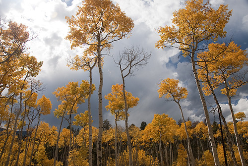
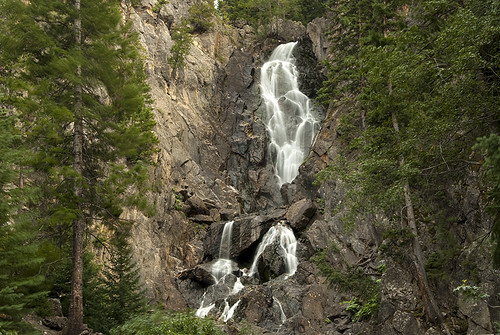
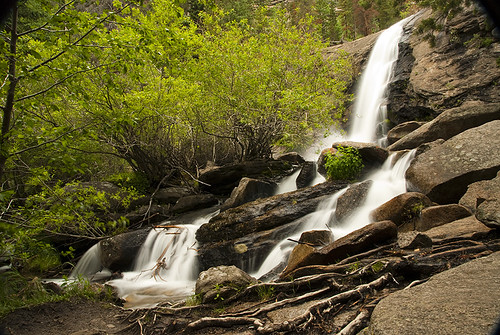
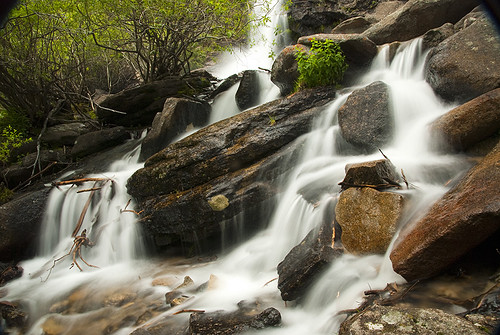
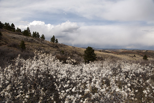
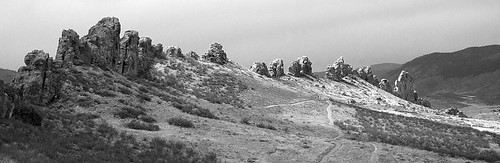
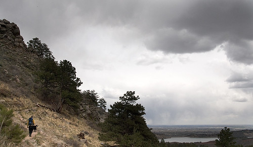
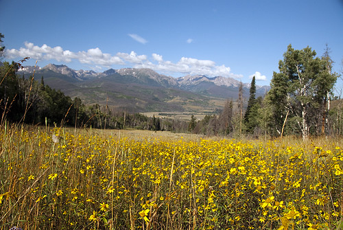
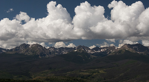
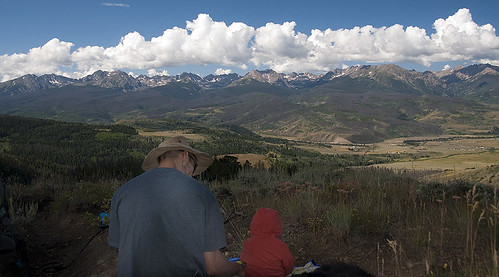
We all have breakfast, and pack our own gear up slowly through the morning. Eventually, we set out to explore the trail that we are parked at the trailhead of. The Acorn Creek Trail is, supposedly, four miles of lightly-used and slightly inclined hiking up the slopes of Ptarmigan Peak. After about a mile and a half, we enter the Ptarmigan Peak Wilderness Area, and at 4 miles, we intersect the Ute Peak trail at an 11,000ft+ saddle in the ridge line.

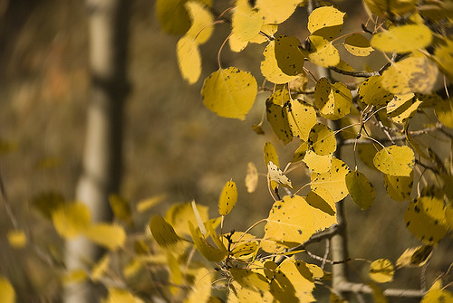
It turns out “lightly-used” means that we have the whole trail to ourselves during the day. It also means that the trail is barely (just barely) more than a bushwack in most places for the first 2 miles. And with all of the rain the previous night, these overgrown fields are sopping, sopping wet.

The trail started to get a bit vague here

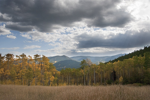
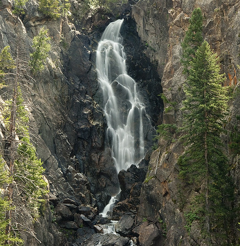
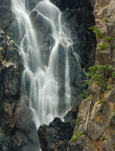
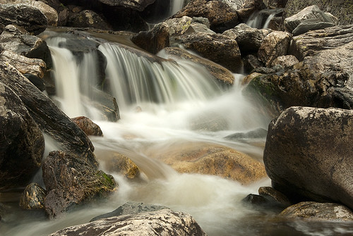
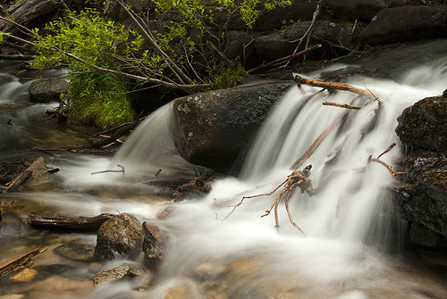
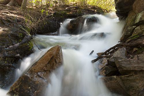
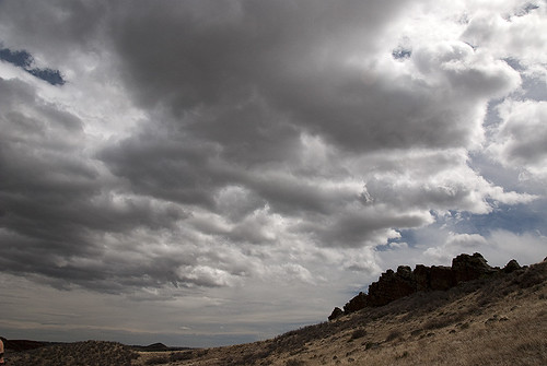
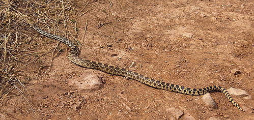
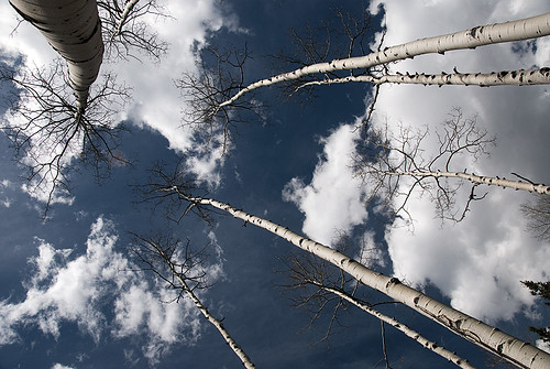
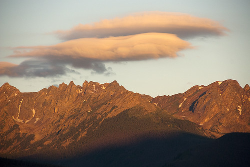
We keep an eye out for Elk as we hike, but aside from some tracks, we see little evidence of them. The trail is steeper than it looked on the map, and I’m having less fun than I’d hoped. We stop for lunch at an amazingly beautiful spot, and then hike another half mile or more to see how far we can get in the afternoon. The answer is “to that big rock, where we turn around.” Wish we hadn’t forgotten our GPS. At about 12:30, a cloud rolls over the ridge in front of us. It’s dark, wispy gray, and rumbles threatingly. We turn around and head for home.

Lunch with a view

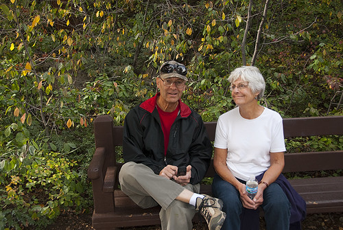
The hike down take half the time of the hike up, and the rest of our afternoon is spent lounging around the trailer. I try to take a nap. G pops the door open once and tumbles out. Mark makes friends with some of the homeowners who live next to the parking lot. And we don’t hear from John until late Saturday night. He leaves a garbled message on Mark’s phone, and we get the gist – no Elk shot today.

Oh well, at least we got to enjoy a day in the mountains. We had amazing views, an adventurous hike, and a quiet evening (after G fell asleep, of course). I can’t think of a better way to spend a weekend!

Has anybody else had unexpected adventures this summer? Share your stories of bushwacking goodness in the comments!!

Morning views from out campsiteWatching the alpinglow light up the Gore RangeMorning mountain viewsG after breakfast in the trailerHiking up the slopes of Ptarmigan PeakGreat views of the Gore range from this trailSitting in a grassy field in the mountainsClouds build over the Gore rangeWILDFLOWERSA spider web in the morning.G napping as we hike into the wildernessThe trail started to get a bit vague hereBut the views were still amazingBlue skies all aroundTrail, what trail? GAHFunny pine treesViews of mountains in the Ptarmigan Peak WildernessTaking a break for lunchBigger clouds building over the distant mountainsStormy skies?Stormy skies?We turn around before the passMorning skies are gorgeous the next day tooPre-dawnNice views to the northOur camper 1Our camper 2

Hiking Bridal Veil Falls

July 8, 2011 at 8:45 am

On our first day of camping in Estes Park, my parents offered to watch G for the day so Mark and I could get out in the mountains. It would have been a perfect day for a long trad climb on Lumpy Ridge, but a few problems presented. One was that we didn’t have a plan before 11a, and you need to be hiking around 7a to finish a route before the afternoon storms in Estes. But even if we decided to chance it, my shoulder was still sore, and I had hurt my foot this week as well.

So, rather than climb, we decided to hike up to another Rocky Mountain waterfall. This time, I brought my snazzy new neutral density filter, and we set out to get some great waterfall shots.

Bridal Veil Falls

The trail to Bridal Veil Falls is 3 miles long, and starts at a very small parking area off of Devi’s Gulch Road on the northeast side of the national park. We were lucky to be there during the week, I’m sure this parking area fills up fast on the weekends.

The first half of the trail is nice and flat, and runs through the valley just north of Lumpy Ridge. In fact, the Gem Lake trail intersects with this one in the middle of the valley.

The trail through the valley

A long this part of the trail, we enjoyed the sun, admired the wildflowers, and were astounded by the flocks of butterflies covering the trail. We weren’t the only ones. We often came upon pairs of hikers just stopped in their tracks in the middle of the trail, gaping open mouthed at the butterflies swarming around them.

Butterflies

The White Admiral

In the second half, the trail starts heading up hill, as it follows Cow Creek towards Mummy Mountain. There are a few steeper sections, and one little scramble that confused many people. You pass a few other smaller waterfalls on your way up, and even some serious looking cascades.

But the trail ends at the base of Bridal Veil Falls. You can’t miss it. Mark and I were amazingly lucky, and had the falls entirely to ourselves for nearly an hour that afternoon.

Bridal Veil Falls

Waterfalls

Lower part of Bridal Veil Falls

It took us about four hours (round trip) to do this little hike, and it was a great way to spend a quiet afternoon in the mountains.

Kate and Mark at the waterfall

Wet Camping in Rocky Mountain NP

June 19, 2011 at 7:13 pm

Rain pattering on the roof of the camper. Trickles of water merge into small streams and creeks and run down the streets of the campground. Clouds billowing over high craggy peaks that loom over us. Rivers raging over mountainsides, boulders, trees, and trails.

Our weekend of camping in Rocky Mountain National Park (RoMo) is a wet one.

Ouzel Falls

The rain starts as we drive up the Big Thompson Canyon on Friday night, and it just keeps going throughout the night. Our friends arrived at the campsite a few hours before, and are sitting in the cab of their camper/truck waiting for us as we pull our rig into the site behind them.

We met Kyle and Briana in Thailand a year and a half ago. Mark and I were just starting to try to get pregnant at that time (and more successful than we realized), and they were on the first leg of their year-long around-the-world trip. In the last year, Kyle and Briana have climbed on four continents, bicycled through 50% of the countries in Europe, been caught in riots in Thailand, and toured dozens of climbing areas around the US while living out of their truck.

Kyle plays an awesome banjo
Briana plays mandolin in the rocky mountains

In the last year, Mark and I created a human being, and have managed to keep him alive so far. Its been a good year for all of us.

G really loves listening to the music

Back to this weekend, and we’re camping in our deluxe 18ft trailer, so it doesn’t matter that the rain is pouring down. We convince G to fall asleep, and then sit around the table telling stories and killing a Bota Box of Malbec as the rain continues through the night.

The prettiest campsite in the rockies!

When we wake on Saturday morning, the air is chilly, the wind is howling, and the rocks are very wet. We decide against trying to climb, in favor of a low-altitude hike to see waterfalls during prime snow-melt season. The hike to Ouzel falls is 3 miles long (6 miles round-trip) and follows a VERY full St. Vrain river starting in the Wild Basin area of RoMo.

We stop for a lot of pictures on the way up. G naps on and off. This time, I remembered his hat, sunscreen, diapers, and bottles, but forgot to stick toys on the backpack for him. He gets a little bored after 2.5 miles, so I tie a carabiner to my hood drawstring and hang it from the backpack to entertain him. This works, but not as well as some face time with Dad next to the waterfall.

Taking a break to play by the waterfall
Rocky Mtn Waterfall 1
Briana and Kyle enjoy the low-key afternoon
Taking a break on the way home

In the evening, we pile our dinner fixings together for a huge skillet of squash, sausage and couscous. Kyle and Briana rock out some great bluegrass tunes. G is fascinated by the banjo. My dehydration headache returns, and I crash with G in the trailer before dark. Mark, Kyle and Briana start up a (typically) heated game of Settlers of Katan, as the sun sets over the continental divide. Eventually, it starts to rain again.

Springtime in Colorado

May 9, 2011 at 7:47 am

As it is the end of May, I realize that this is more like summer in large parts of the country. But out here, the weather is just warming up, snow in the mountains is starting to thaw, and we Calders are starting to creep out from our winter cocoon!

Plums in Bloom

Since my last post, we’ve managed to get out on the trail and do some really great hikes. Of course, these are made all the more fun (and adventurous) by the presence of little G. When he was younger, we hiked with him in various supportive chest carriers. These early spring hikes were very weather and baby-temperment dependent, and rather hit or miss.

Mark and G hiking

For instance, in mid-April, we attempted to get out and hike a low altitude, relatively easy trail in Loveland that follows a sandstone ridge known as The Devil’s Backbone. We put G down for his morning nap, got our stuff together, and figured we would head out as soon as he woke up. Of course, that was the morning he decided to sleep for two and half hours!

By the time we reached the trailhead that afternoon, storms were blowing in. The wind howled along the ridgeline, blowing sand and dust in the baby’s face and the skies threatened to open up and pour at any minute. We walked about a quarter mile before giving up, and sending Mark and G back to the car. I hiked a little further to get some photos and then turned around and headed home.

Dramatic skies

The length of his spine

Gopher Snake

On the day of G’s six month birthday, we stopped in at REI and found a great deal on a Deuter Kid Comfort II hiking backpack. Finally, Mark could walk on the trail and see his feet, and G could ride behind in relative comfort.

G in the Foothills

Our first trip out with this new setup was the 3.5 mile hike to Arthur’s Rock just west of town. G did really well, despite the cold winds, his chilly hands, and the new carrier. Near the summit, we had an interesting and very chilly diaper change, and a tired baby who just wasn’t sure how best to fall asleep in the backpack.

Mark and G Hiking High

Mom and Baby on the summit of Arthur's Rock

Mark and G hiking down in the sun

A week later it was Mother’s Day, we had one of the prettiest weekends we’ve seen all year. The sun was out for 2 days straight! The wind was calm, and we got out for some camping and hiking. We parked the trailer at a fancy RV park in Golden, and spent the weekend learning the systems and exploring the area west of Denver. We stopped by Red Rocks on Saturday morning, which was being used as a work-out venue for about 200 Denverites. We started calling the area “The Red Rocks Athletic Club” after watching people run and jump up the bleachers, stop and do sit-ups along the way, and a huge group of bootcampers working out in the upper amphitheater.

My boys in the mountains

In the afternoon, we drove up to Golden Gate Canyon State Park and hiked the 2.5 mile long ‘Racoon Trail’. The day was warm and sunny, and we had a really lovely time. G got tired about 45 minutes into the hike, and had trouble getting comfortable enough to sleep at first. There was some serious baby crying for about 15 minutes until he gave in and just zonked with his head against the rest in front of him. Poor G is still trying to figure this stuff out, and poor Mark had a screaming baby in his ear for almost a mile of trail, but we had a good time otherwise.

Mark and G hiking through a ponderosa pine forest

Mark and G hiking through an ancient aspen grove

More Very Tall Aspens

View of Rocky Mountain NP from Panarama point in GGCSP

Now that springtime is officially here, life is getting easier and we’re having a ball. We’ve even been out to climb once so far, but I’ll leave that story for another time. Right now, G is waking up from his nap, and we’ve got packing and prep to do before the long Memorial Day weekend!

Fall in Colorado

September 18, 2010 at 6:27 am

It’s still a bit early for the true autumn glory in our part of the rocky mountains, but last weekend Mark and I drove up to Pingree Park looking for some great fall colors. And we weren’t disappointed.

Glowing Leaves

Yellow trees and blue skies

The poudre canyon was still very green in the second-to-last weekend of September, but as we climbed to higher altitudes we saw more and more color.

Aspen Homestead

Blue skies and yellow trees

Aspens in the breeze

We stopped a long the way for a little bit of hiking. As hunting season has recently started, Liv wore her “Please don’t shoot my dog” orange safety vest on the trail. At eight months pregnant, I’m actually feeling better (relatively) than I did in the first few months! But, I get winded when hiking up hill very quickly, and it’s rough not being able to take a full breath any more.

Liv wearing her safety vest

Eight Months!

It was a very nice afternoon, though, and I’m looking forward to making some more great pictures as the season continues!