Hiking Crown Point

August 23, 2009 at 1:34 pm

It was a sunny Sunday morning in August, and I told Mark I was suddenly in the mood to do some shopping. He suggested hiking instead.

Distant mountains peak above the trees

Two hours later, it was about noon, and we were starting out on the Brown’s Lake trailhead, with clouds blowing in and the Comanche Peak Wilderness as our goal.

Watching Rain

Within the first mile, we passed two other couples hiking out, both of whom alerted us to the fact that it was probably going to rain and thunderstorm on us very soon. As the trail we were on runs above treeline for many miles, the threat of lightening was a very real one.

Watching storms pass us by

We decided to take advantage of the few minutes before rain by climbing Crown Point, a 11,500ft high peak about two miles in from the trailhead. The trip to the top was very easy, and the views of the distant Neversummer range were completely beautiful.

Neversummers

From there, we descended to the wilderness boundary before deciding to tuck tail and run back to the car.

Big dark clouds form overhead

We’ve tried to hike to Brown’s lake twice now, and been unsuccessful both times. Let’s hope the third time is the charm!

Climbing Mt Sherman (14,036 ft)

July 18, 2009 at 6:20 pm

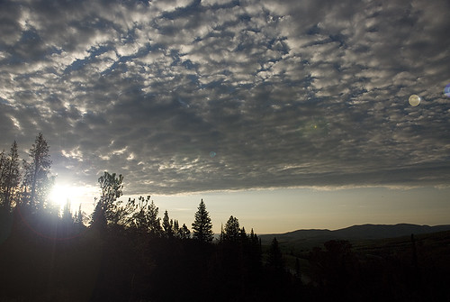
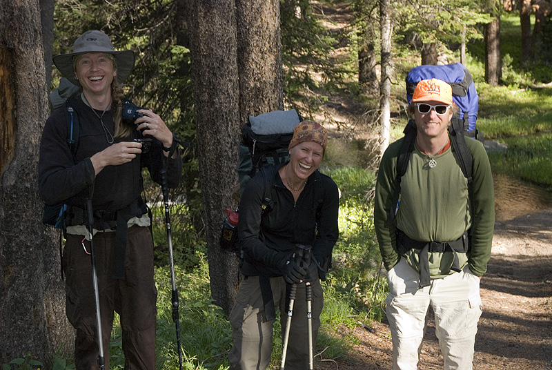
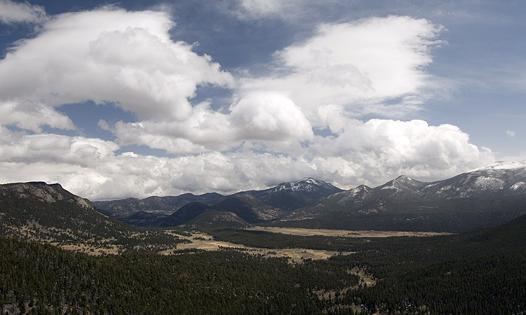
Mark and I totally mooched along with plans from a group of transplanted Michiganders for a hike up our 7th Colorado 14er (a 14,000ft+ tall mountain) last weekend. Doug and Liz’s friends Brian and Sarah recently bought a condo in Silverthorn, and were kind enough to let us crash on their floor Friday night. Saturday morning, the nine of us in this group got up at 5am, packed into two cars, and drove south for an hour to the Fourmile Creek trailhead for a summit attempt on Mt. Sherman.

Mt Sherman is visible from where we park the cars

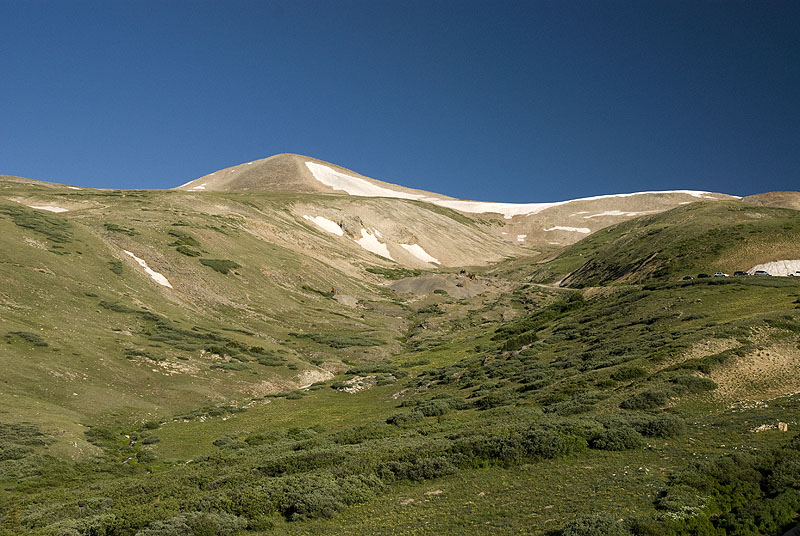
Mt Sherman is considered one of the easiest 14ers in Colorado. The round-trip hike is estimated to take a little over 5 miles, and has only 2,000ft of elevation gain. Most of the trail follows an old mining road. Only the final bit of climbing to the summit ridge presents any difficulty, where you have to scramble through some rocks on a relatively thin ridge-line. But we never felt like we were in any danger.

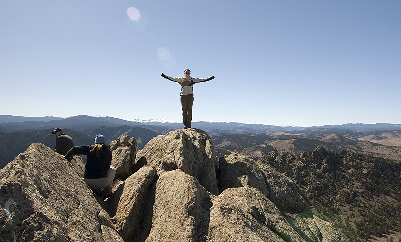
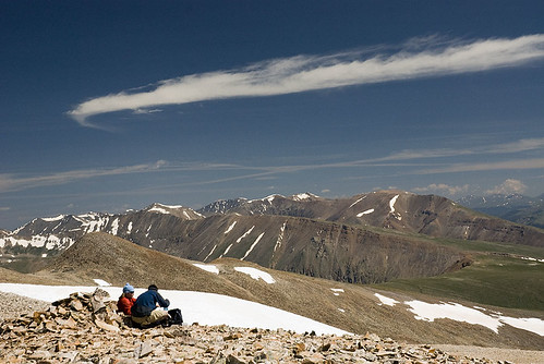
We left the car at around 8am, and arrived at the summit at around 10:30a. Even though the route was “easy,” I was still huffing and puffing on the steep sections, and stopping to take plenty of “photo breaks.”

Old Mine Equipment

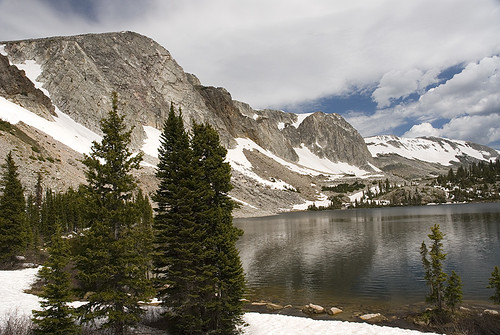
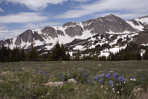
There’s more photos from the day in the gallery.

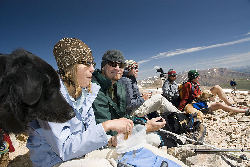
Being one of the easier big-mountain climbs in our state, Mt. Sherman is rightly popular. And we saw huge numbers of people in the long line up to the summit. There were kids, and older people, hard-core mountain runners, lots of dogs, church summer camps, and big families. I know people often complain about the crowds on Colorado’s 14ers, and they’re not exaggerating. But Mark and I spend enough time at remote trad crags and back country campsites, that I’ve started to really appreciate an outdoor crowd. Sometimes an adventure isn’t just about getting to the top, or seeing the best view, but also about the people you meet and the friends you make along the way.

Hooray! We climbed another big mountain!

The gang hung out on the summit for about an hour. We took a lot of pictures, ate lunch, enjoyed the sunshine, and partied with the crowd on the summit. Mark and I were the only ones in the group to sign the summit register, but it’s one of my favorite parts of climbing a big mountain, so I gotta do it. The battery on my camera went dead just after our summit photo, so no pictures on the way down!

Enjoying the summit

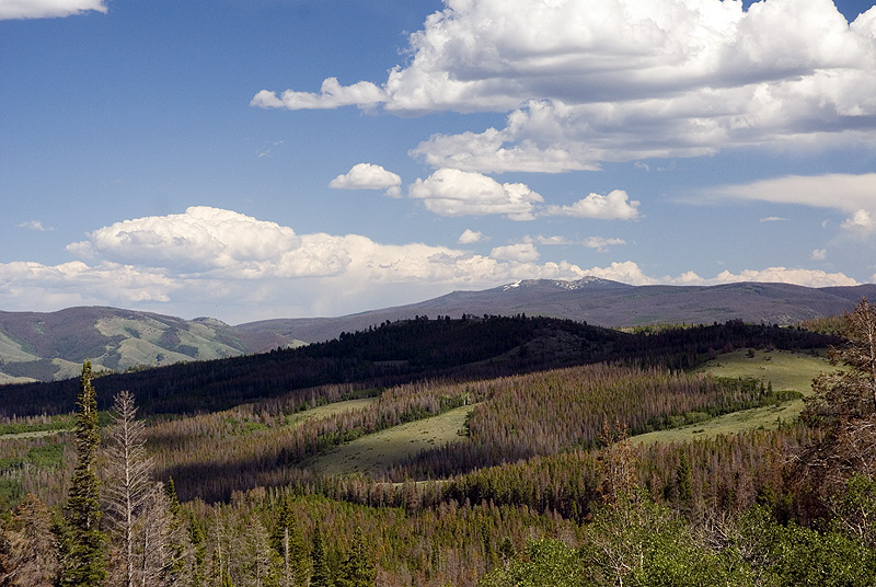
We looked at the map, and discussed plans for further hiking. Two in our group decided to head down, and the rest of us hiked over to Gemini Peak, a 13’er just east of Mt Sherman. Mark and I walked up to the base of the steep cone of rotten-looking rock, and decided the last 100ft of wind-blown creepy-looking climbing might not be worth the trouble. As the rest of the group worked their way up the pile of rocks, we headed back towards the car.

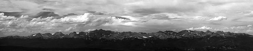
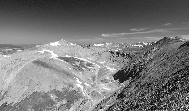
Rather than hiking back over the summit of Sherman, we consulted our maps and decided to try to cross-country hike over the White Ridge and down on a direct line back to the cars. We took it slowly, approaching each new change in grade of the ridge with care, making sure the path ahead was passable before attempting further decent.

The views are amazing on all sides

As the hill side really began to get steep, we started following a small creek, and found a trail carved into the side of the hill next to the drainage. Woo hoo! We followed this small, loose, wavering trail down the hill for quite a while, until it ended in a wide snow field.

Mark and I do a good bit of rock climbing. But we’ve never owned ice axes and have never done any snow climbing, ever, before. In fact, in our world, snow is to be avoided at all costs. But Mark was enjoying the sunny day, and we found that you could do some nice ski-type sliding on this gently sloping snow field.

The next snow field was steeper. Mark took his “skiing” up a notch, and was basically in full-flight standing glissade (a mountaineering term for “sliding down a snow field”) until he lost his balance and landed in a splash of soft, wet snow. I walked around.

The third snow field was wider and steeper still. This time, Mark’s standing glissade was nicely balanced, and I decided to do the whole thing in a sit-glissade. I slid down the 50ft snowfield on my butt, and had a fabulous time!

There were probably 4 or 5 more snow fields on the descent. We attacked each one with glee, alternating between standing and sliding on our bottoms. We had SOOOO much fun. We threw ourselves down these slippery slopes with such energy and enthusiasm, that we were down at the cars before we even realized it. We checked our watches and found that we had descended most of the mountain, the last 1500ft or so, in less than 25 minutes! And done it all sliding on the dirty snowfields left in the middle of July. It was so much fun!

We were the first ones back to the cars, but only waited for maybe 15 minutes before the other 5 hikers (who climbed Gemini Peak) came sliding down the same drainage we had been on. They had followed our foot prints, foot slides, and butt prints all the way down the side of the mountain. The two who had started their descent first were the last to arrive at the car.

It was a great day, and we had a lot of fun with everybody. I really hope we have a chance to hike, and maybe slide, with everybody again!

Dylan and Ann’s CDT Send-off

July 1, 2009 at 3:17 pm

Wow, I am way behind on blog posts right now. I suppose it’s a good thing to be doing more stuff this summer than spending time writing about it.

The Sun Peaks Through

Last week, Dylan and Ann started their month long walk across the Continental Divide Trail (CDT) in Wyoming. They left from the boarder of Colorado and Wyoming on the morning of July 1st, and hope to be crossing the boarder of Wyoming and Idaho, about 550 miles of trail later, on the 29th. How crazy and awesome is that?!

Dylan is a great blogger, and will be posting maps and details of their epic hike on his blog. I highly recommend checking it out.

Happy hikers excited to start their adventure!

As the start of their trail was essentially “in my neighborhood,” and I haven’t seen Dylan and Ann in months, I took a few days off of work and drove up to see them off. Mark couldn’t get any extra vacation, so I did this trip on my own, which made it extra adventurous for me. I don’t travel by myself very much, so the three hour trip across empty, wild, Wyoming, and a night of sleeping in a tent by myself, were a novel and welcome experience.

I felt inspired to make some nice photography on this trip, so be sure to check out the gallery page.

Clear Calm Morning

The CDT crosses the boarder of Colorado into Wyoming just south of Encampment, WY, which is a quiet, beautiful, mountainous area that I have never visited. When I arrived on Tuesday afternoon, most of the group had gone out to kayak and swim in Hog Park Reservoir, a beautiful mountain lake just off the boarder. We stayed at Bottle Creek Campground, where we were the only campers.

The area has been hit hard by bark beetles. I’ve never seen a forest so brown with dead trees in my life. Certainly more than half of the trees, across large swaths of the forest, were orange-brown and crispy. It looked a bit like a fall view, until you remember that these are evergreen trees, and your heart sinks.

Southern Wyoming, and a lot of beetle kill

Dylan and Ann and their friend Pete were all ready for their long hike. We hung out Tuesday night, talked logistics and plans, played with cool new ultra-light gear, discussed the trail over the first week and the tasty Thai restaurant in Rawlins, WY. On Wednesday morning, we roused at 6am, and were on the road towards the boarder before 7a. The 30 miles of dirt road to the boarder took about an hour to drive, and the happy, hardcore hikers got on the trail around 8:30a on the morning of July 1st! Bon Voyage, mes amis!

The Snowies

After they walked off into the mountains, I rode back to the campground with Ann’s wonderful parents, talking about tropical meteorology the whole way, and then started on my way home. This time, instead of driving across the wide open plains on I-80, I decided to take WY-130 through the Snowy Range on my way home. This turned out to be a great decision.

Wildflowers in the Snowies

This little road drives right over the crest of the Snowy Range, a beautiful group of mountains just west of Laramie. The road tops out near 11,000ft, it’s not quite as high as Trail Ridge, but it feels very close. I didn’t get much hiking in, as several parking lots were still filled with 10ft drifts of snow, and several trails were lost under huge drifts, still, on the first day of July.

But I drove over the mountains, I enjoyed the views, I made some photographs, and I vowed to come back.

The Diamond reflected in Mirror Lake

Backpacking… below mountains… somewhere

June 7, 2009 at 8:31 pm

Hmm, I’ve had a lot of trouble coming up with a title for this trip report. What exactly did we do last weekend? Where were we?

We were definitely backpacking. There were backpacks and hiking and camping involved. But all of the words that I had used to describe our planned trip – “Backpacking in the Comanche Peak Wilderness” or “hiking to Browns Lake” – just don’t really fit the actual outcome. Here, let me explain.

We woke up in a grapenuts commercial!

There are pictures from the weekend in the gallery.

We left Fort Collins a little late on Friday, and after an hour of driving up the Poudre Canyon Mark asked me “So, how do we do the tooth-brushing thing in Bear territory?”

I responded with “Oh no! I forgot the water bottles!”

Yep, we were all ready to hike into the rapidly darkening woods, and had discovered that we were missing: all of the water bottles, Mark’s headlamp, warm hats and gloves, the bear spray and batteries for the GPS. We bought four bottles of Dasani from a camp store further up the canyon, and decided we would just have to live without everything else.

A little creek runnng high

We finally got to the trailhead much later than we were hoping, around 8pm. As we drove along the winding mountain road, we pulled around a corner and nearly ran over a very large moose and her calf. It was one of those startling moments that really gets your blood pumping. Moose are HUGE.

So, here it was, Friday night. Nearly dark. Only one headlamp for the two of us. Four crappy plastic bottles of water. No GPS. No compass. Close encounter with very large wildlife. I was ready to head home at this point, but Mark was too excited to contain. We parked the car and hiked out into the darkness.

A great spot to take in the view

Actually, it wasn’t that dark. There was a full moon. And it wasn’t that cold. We got about a mile into the trail and then walked off into the woods, set up the tent, and enjoyed a night lost in the wilderness.

After all of the mistakes and problems from the first night, the rest of the weekend was surprisingly smooth. We had originally planned to camp Saturday night at Brown’s lake (around 10,500ft), but comments from other hikers dissuaded us. After hearing “It was freezing up there last night!” “The wind never stopped!” and “There was so much snow!” we just decided to try to hike up to the lake, and camp down near the reservoir.

Fall Peak, Comanche Peak, and an unnamed 12'er in this ridge

We stashed the packs at the end of the Brown’s lake trail and climbed up a mile and near 1,000ft of elevation gain into the woods below the lake. Here, the snow was still very deep. We post-holed in up to our hips, loosing entire legs in the freezing piles. The trail was difficult to follow, and, as far as we could tell from just our map, we were still more than half a mile from the lake. Not worth it. We went back down.

An approximate route and waypoints for our weekend

So, we never camped in the Comanche Peak Wilderness. We never saw Brown’s Lake. We really walked up and down 6 miles of trail that runs across the valley floor below the Mummy Range and the northern boundary of Rocky Mountain national park, and that was a great way to spend the weekend.

It certainly wasn’t what I was planning, but I’m not going to complain. We learned about what to make sure we remembered to pack. We learned that walking in the dark doesn’t result in being eaten by wolves. And we learned that we have the most fun when we go with the flow. Relax, re-evaluate, and keep on truckin’.

Spring in RoMo

May 3, 2009 at 7:59 pm

We got a break in the weather on Sunday and took off for the mountains. Mom and I went shopping in Estes Park and then we all drove up through the National Park. We watched elk, played in the snow, and walked on Trailridge Road past the closure.

There’s some nice and fun pictures from the day in the gallery.

Christi and Katy up high in the national park
Mom and Katy at Many Parks Curve

Moraine Park
View over Moraine Park from Trailridge Road

Elk sitting below pine trees
A young elk laying beneath pines

Mummy mountains
The Mummy Mountains

Magpie stealing a ride
A Magpie catches a ride on a grazing elk

Mountains and cloudy skies
Mountains and clouds

We haven’t been climbing in a while, and it will be several more weekends before we get the chance. But May is lining up to be a great month, with a lot of beautiful trips planned. Our brief time in the national park left me desperately craving more time in high places. Soon the snow will melt, and we will return.

Hiking to Hanging Lake

April 20, 2009 at 7:41 pm

On Monday morning we had to pack up and head home. The weather in the mountains was beautiful, but I was feeling grouchy and a little depressed about going back to “real life.” After picking fights with both TJ and Mark for no reason, and then having a little emotional breakdown, I pulled the car off the highway and decided that a hike sounded good. We all needed a few more hours in the mountains, and another dose of endorphins (some of us more than others).

Trail is difficult! I'm ready to hike.

There’s pictures from the hike in the gallery.

We knew next to nothing about this trail. I’d seen signs for it as we drove through Glenwood Canyon, and one of our neighbors had declared the Hanging Lake trail to be his favorite in the entire state of Colorado. So we read all of the signs at the rest stop, and figured out that the trail started around the corner, was 1.2 miles long and rose in elevation from 6,XXX and 7,102 ft (as was written on the sheet of paper at the trailhead). We packed up water, cameras and lunches and headed out for the hike.

TJ and Mark climb the rocks and steps to the high lake

The trail was steep and rocky, but well maintained. The last 0.3 miles of the trail were covered in ice and snow. And the last few feet were very steep climbing up a blocky ledge system. Once over the ridge and on top of the canyon, you pop out and get your first view of the lake.

Waterfalls into Hanging lake

The lake sits high above Glenwood Cayon, filled with crystal clear water, surrounded by waterfalls running with spring snow melt, and crowned by granite cliffs. The lake is so beautiful, that planners re-routed the interstate though two tunnels rather than disturb the spot. We loved sitting next to this clear alpine lake on the sunny and beautiful afternoon. I ran around taking pictures of the waterfalls, and TJ and Mark watched trout in the deep, clear lake dart out of the shadows and eat insects off the surface.

Waterfalls

We spent a quiet hour next to the lake, eating our lunches, and getting just a little more sunburnt. The hike out was quick and we were back in the car, driving though the mountains in what seemed like no time. Everybody was definitely feeling better.

Hiking Greyrock with the Gang

March 14, 2009 at 7:56 pm

It’s spring, it’s my birthday, and I’m lucky enough to have my favorite group of friends together one more time. Over the weekend, Dylan and Ann came up from Santa Fe, and we joined them with Doug and Liz and Sean for a big dinner on Friday night and a hike up Greyrock Mountain on Saturday. There’s some pictures from the sunny Saturday hike in the gallery.

Heading up the trail to the summit!

The hike to the summit of Greyrock is a classic jaunt, starting in the Poudre Canyon northwest of Fort Collins. Doug asked me how many times I’ve hiked this trail, and I came up with a number around 12. I think Saturday was our 13th! It’s amazing that you can do a hike so many times and still love it so much. It was a beautiful day, a wonderful place to get some more miles on my boots, an amazing view, and great friends to share it with.

On the Summit

Kate on the summit blocks

Thanks, everybody, for a great day, and sore legs! Let’s do it again next year!

Liv is having an awesome day!

Fall Colors on White Pine Pass

October 4, 2008 at 8:27 pm

The weather is changing. The nights are cooling off. The patterns are shifting. Our weekdays are sunny, warm and beautiful. Our weekends have been rainy and gross. So, Mark and I decided to take a short break from climbing and search out some of the best fall colors in Colorado. We ended up on the West White Pine Mountain trail, early on a Saturday morning.

Aspen grove

There’s about a ba-jillion amazing photos from the day in the gallery!

I know, I know, Dylan’s awesome GeoMashups plugin will make the same cool google maps of my gps data as the one I just stuck in here. But I’ve been to lazy to upgrade, I’m sorry. It’s on the list for this upcoming rainy weekend, I promise!

Fall in Colorado

So, for our hike, we headed about an hour west of town, up and down some winding remote canyons, and eventually found our way to this trailhead. We have hiked this trail (to the summit) before, and I knew the aspens would be fantastic. In fact, they were totally amazing.

Everything is glowing yellow

It’s October in Colorado, and hunting season is in full swing. I knew this trail was remote and had easy access by 4wd vehicles, so we brought bright colored clothing for the whole family to make sure we were visible to any hunters in the area. Liv had to deal with wearing one of Mark’s red shirts for the day. It made her look completely goofy, and she got comments all day long. But she didn’t get shot at! On our way home, we stopped at Jax and bought her a hunter’s orange vest.

Liv thinks a walking stick is an automatic toy

We hiked up to the pass, meandering through aspen groves, pine forests, and open prairies along the way. Our GPS track looks a bit like confused moose wandering up the side of the mountain. On this trip, we didn’t hike to the summit of either peak, though. The aspens were our goal, and they petered out just below the saddle.

There are some amazing views on this trail

When we got home, I had almost 400 shots of yellow aspens on my camera! So, it’s going to take a while for me to get all of my favorites up on the site. But, I think there’s enough here now to show it was a fantastic day, and a really amazingly beautiful hike.

Scarred aspen bark