Anniversary Weekend in Colorado Springs, Part 2

September 28, 2008 at 6:09 pm

So, I’m a bit behind in blogging this, but there are some nice photos from our second day in Colorado Springs up in the Gallery.

Mark and Kate at the Silver Falls overlook

On Sunday morning, Mark and I woke up late, packed up, checked out, and hit the road. We were due to meet my bro Kev in Denver at around 2pm, so we didn’t really have time to climb. The hotel, and many billboards in the region, extolled the amazing, unforgettable, unimaginable, fantasmagoric beauty of the Seven Falls area. We thought that sounded like a fun way to spend a Sunday morning, so we headed up to check out the Falls after breakfast.

Helen Hunt Falls - $18 dollars cheeper than the others!

That’s not a picture of Seven Falls. Nor is it a photo of two of seven falls. No, when we got to the canyon where the waterfalls were, signs lined the road declaring that we were about to drive down the “Most beautiful mile of road IN THE WORLD!” This sounded pretty good.

We rounded the bend and the toll booth appeared in front of us. Ah. Such is the way of tourist traps in the mountains. They wanted us to pay $18 ($9 each) to drive down a mile of road and see the waterfalls. We didn’t think it was worth it.

It reminded me of the classic Grandfather Mountain U-Turn of 2003 (We wouldn’t pay $24 dollars to drive up the side of the mountain), or the legendary Royal Gorge reversal of 2005 (definitely never going to pay $40 to walk across a bridge).

Just another side waterfall in the autumn

So, following years of precedent and tradition, Mark swung the Prius around and we drove off in search of free waterfalls. We headed up the next canyon to the north, which was free and very beautiful. At the top, we checked out Helen Hunt Falls (very pretty, and a pioneer woman). There was a short trail, and we hiked up to Silver Cascade falls and enjoyed the view of the canyon and the long, lovely water fountain that slithers from the top of the rocks.

Silver Falls has a wild little standing wave

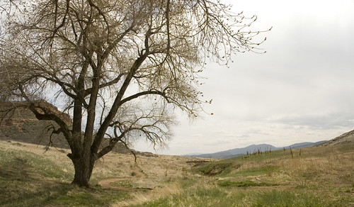
After the waterfalls, we headed down the Goldmine Road – a narrow two-way traffic dirt road that winds down the rim of the canyon and back to the Springs. It was a warm, sunny afternoon, and the trip home was too quick.

Climbing Sugarite Canyon: Part 2

September 14, 2008 at 6:08 pm

I love the state motto for New Mexico: Land of Enchantment. You just can’t walk around the desert and mountains in this place and not feel some kind of mystical connection with the land, the sky, and the ancient Native Americans that also walked through these mountains. Maybe it’s the low population density, or the beautiful mesas and desert rock formations. Whatever it is, every time we visit the state, I feel like I’ve gone someplace beautiful and remote, a wild and exotic land, that is barely part of the world I live in every day.

Sunrise at Sugarite

I woke up early and energized on Sunday morning. Mark and I had to leave by noon to make a Sunday evening commitment, but nobody was stirring when Liv and I set out on the trail. Even though the sky was deeply overcast, I took the dog and hiked up to the top of the mesa we had been climbing on the day before, in the hopes of getting some pictures of the sun rising over the canyon, or the desert beyond.

A distant desert beyond the morning clouds

The trail to the top edge of the mesa was about 2 miles long, and probably took Liv and I about an hour to do. The clouds were breaking up as I reached the edge, and the sun had long since risen. There were no incredible sunrise pictures for me that morning, and judging by the moist, cool breeze coming over the the mesa, there would be no climbing before we had to leave at noon either. But it was really nice to sit on the edge of the cliff, in the quiet desert morning, and watch the clouds slowly roll over the canyon and lands far beyond.

The day gets sunny and beautiful as we leave the canyon

Eventually, I left my little perch and hiked back down to camp. The rest of the gang were hanging out in Dylan and Ann’s camper, drinking lots of coffee, making biscuits for breakfast and doing crosswords. I really suck at crosswords. Evidently, “creative spelling techniques” are not part of the challenge of the puzzles.

The clouds slowly burnt off, and Dylan and Ann decided to head up the hill for another day of climbing. Mark and I packed up camp and reluctantly headed home to our normal lives. It was a very nice, if too short, weekend away from reality.

Hiking the Ute Trail in RMNP

August 30, 2008 at 8:36 pm

My parents and little brother were in town for the first few days of the long weekend, so we head another excuse to spend time hiking in the mountains! This time, we drove up high in the Rocky Mountain National Park, and ended up hiking several miles down the Ute Trail.

Our hike on the Ute Trail on a Topo map
Our hike on the Ute Trail elevation profile

There’s nice pictures from the day in the gallery.

The trail does not gain or loose too much altitude. But it starts high and stays high. We parked our car at around 11,450ft, and started walking up the gradual slope from there. It’s amazing what a difference a few thousand feet can make in your hiking, even for Mark and I who are getting a little more used to these altitudes. It felt like we had all suddenly gained about 50 lbs to carry up this hill.

Dad and Kevin hiking at 11,500ft

The views along the trail were fantastic, and, miracle of miracles, the trail was quiet. We had found one of the most beautiful places in the park, and saw only a handful of other people near the trailhead. Once we were around the corner and on the true ridge, we were alone with the wind, the mountains, the marmots and the sky.

Long's Peak panorama

Mom, Dad and Kevin turned around at the high point of the trail, after enjoying 360-degree views of the highest peaks in the national park and of Estes Park. It felt like we were standing eye-to-eye with Long’s Peak, and we could see out over the Neversummer range to the western slope. Mark and I picked up the pace and cruised down the last half mile to Timberline Pass, where we took a bunch of pictures and then turned around.

Rocky Mountains

Looking west towards the Never Summer Mountains

The Ute trail actually goes through a large part of the national park, and could be hiked all the way from Trail Ridge road down to Beaver Meadows, over six miles further. The sign at the trailhead told us that the trail we were walking on and trailridge road were built on the trails used by the Ute Indians, hundreds of years ago, as they migrated from winter to summer camps. I think the idea of a migratory life, being able to move from place to place in the Rockies as the weather changed and the plants and animals move, sounds wonderful. Though, I don’t know how well I’d do carrying a baby and all of my belongings over this 11,500ft ridge.

By the end of the day, we were all pretty tired, even without participating in a mass migration. Kevin drove us back down the mountain, and we had a great dinner at Ed’s. Another great hike everybody!

Hiking Greyrock with the Calders

August 23, 2008 at 9:41 pm

Two fortuitous events unfolded last Friday. The first: Mark’s parents and brother arrived in Fort Collins to spend the weekend with us! The second: REI began their Labor Day Sale, and marked down their Garmin Colorado GPS Units 25% off! Despite the load of lack luster reviews on the interwebs, I went and played with the selection at REI and ended up buying a 400t. This is really fun, because the GPS that Mark bought for me, oh so many years ago, officially stopped being able to find satellites or stay on for more than 20 minutes about two years ago. We do just fine with maps and guidebooks, generally, but a GPS makes looking at your hiking stats so much better!

Our GPS track in Google Earth

The elevation profile of our hike (approximately)

So, on Saturday, we took our new toy and our family and headed out for the classic hike up to Greyrock Mountain, just northwest of Fort Collins. We arrived about mid-morning, and took a leisurely pace up the canyon, enjoying the sun and the mountains.

There’s more pictures in the gallery!

Jeff is enjoying the mounains

Kathy and Bruce enjoy a quick break

Unfortunately, bad weather started to roll in approximately 1.92 miles into the hike. Mark, Bruce, Jeff and I all sprinted the last 0.2 miles to the trail junction below Greyrock. We got in our obligatory photos of the mountain and then turned around and headed down.

We got a bit of rain and wind on our way down, but nothing too bad. As usual, the hike out was much faster than the hike up. Everybody was happy to make it back to the car at the end of the day, and we celebrated with tasty ice cream in Old Town. Nice hike everybody!

Classical Greyrock

A Lovely Day in Rocky Mountain NP

July 19, 2008 at 10:58 pm

Mark and I made reservations at a campground just outside the park, found a friend to watch the dog, piled all of our gear into the car and took off for the mountains on Friday night. We had planned on getting up early the next morning and climbing and awesome, long, grade III route the next morning. But, Friday night, after putting up the tent, we found out that Mark didn’t have a helmet.

While many people (and even many trad climbers) might feel completely comfortable climbing any route without a helmet, it didn’t seem worth the risk to me or Mark. So, we decided to drive back to the Fort on Saturday morning, grab the helmet (and a few other forgotten things) and then head back to Estes. We would climb someplace low and easy on Saturday afternoon, and then get up early and do our long climb on Sunday.

There’s good pics in the gallery.

Rocky Mountain National Park

But, it turned out that Mark’s helmet was not back at the house. It wasn’t in the basement, car, backpacks, front yard, or under the poppazon. It was gone. We drove back to Estes empty handed. Neither one of us felt much like climbing when we got back to the national park just before lunch. Instead, we took our picnic lunch up Trail Ridge Road, and sat and ate it at 11,000ft.

Beautiful rock and snow

We drove over the continental divide – our first time on this road in a few years – on a lovely day. It was also our first time above treeline all year, and we were both happy to find that neither one of us had a problem with the altitude on Saturday.

Eventually, we randomly found ourselves at the Poudre Lakes, the actual start of the river that carved the beautiful and amazing Poudre Canyon and runs through Fort Collins. We were so excited to find this spot, that we parked the car and headed out for a quick afternoon hike.

Wildflowers in the glacial valley

The Poudre River trail runs along the side of the river, through glacial valleys and rocky canyons, until it pops out near Joe Wright Reservoir off of highway 14 near Cameron Pass about 20 miles to the north. I would love to backpack this trail someday: start at Trailridge road in Rocky Mountain and end up in the familiar playground of the southern Rawah Mountains at the top of the Poudre Canyon. What a great adventure!

Standing in the young Poudre River and looking down stream

This weekend, though, we were not prepared for that adventure. We walked a long the scenic trail for a couple miles and then headed back to the car. We drove back over the divide, gawking along with the tourists at huge herds of elk and yellow-bellied marmots along the way. We ate junk food for dinner, chased mule deer out of our neighbor’s campsite (one got away with a banana), saw a badger for the first time, and enjoyed a mountain evening.

We talked around and around, and eventually decided we could do the climb without Mark’s helmet the next morning. And that’s a story for another post.

Sun and Snow in Rocky Mountain National Park

June 15, 2008 at 10:44 pm

Mark and I camped Saturday night with Doug and Liz, enjoying a warm evening in Estes Park and the smooth classic rock melodies from our fellow campers until the wee hours of the morning. When we awoke on Sunday, we made a tasty breakfast, Mark chased our tent across a field, we packed up, and headed in to the National Park for a day of mountains and vistas.

There are more pictures up in the gallery!

Doug and Liz enjoy the view (after I told them to)

Doug had big plans for our day, and had picked out a great hike that, with use of the park shuttle, would send us over a remote 11,000ft pass and have a net elevation loss of over 1,000ft. Unfortunately, the snowpack this year has been … wait for it … leg-en-dare-ree. And the rangers at the Bear Lake trailhead were ready to physically block us from heading up this trail without appropriate gear (crampons, ice axes, avy beacons, sunscreen, food for a week, emergency shelters, etc). Rather than invoke the wrath of 6-10 retirees in ranger uniforms, we agreed to head lower and hike out to a few very pretty, but less remote, alpine lakes.

Google Earth view of our Hiking trails

We waded through tourists in shorts and tank tops for the first mile or so, but the crowds thinned when the trail steepened above Alberta Falls, and began crossing over large snow fields. The trails over the (very deep) piles of snow were well packed, but we were all happy to have our trekking poles as we slipped and slid all over the stuff.

Liz carefully walks down the steep snow field

We hiked all the way up to Loch Vale first, which ended up being a little less than 2.5 miles from the Bear Lake trailhead. I’ve been to some beautiful areas of Rocky Mountain, but this little lake has to be one of my new favorites. It was simply stunningly beautiful. I couldn’t stop taking pictures of the snowfields, the rocks (is that the Petite Grepon?), the birds, the fisherman, the mountains and the glaciers. I did a little yoga self-portraiture for my photography portfolio, we all ate lunch, and enjoyed the spot.

Natural Natarajasana

We hiked back down the hill, refilled the water bottles, took long exposures of the very full rivers pouring out of the glacier, and a mile later we were up at Mills lake. Mark and I had been here before, when we climbed the Spearhead a few years ago, but it was nice to be here in the daylight, not exhausted and able to take more awesome pictures.

Mills Lake

On a normal day in June, we would be able to hike well above any of these lakes, but there was just too much snow this weekend. It made Doug and Liz nervous about their upcoming trip to Yellowstone, but made Mark and I more secure in our decision to not climb the Grand Teton next week. Hopefully, though, most of this snow will be melted off by the time we’re ready to climb the Petite or maybe even Long’s later this summer…

Memorial Day Weekend in Voo, Part 1

May 24, 2008 at 10:19 pm

“This is ‘high country’ and wind is ever present, whether just a light breeze prowling through the aspen groves or near hurricane force gales. Storms of near bestial proportions are spawned in the snowy range … and many times descend upon the valleys of Vedauwoo.” – Skip Harper

Pictures from the weekend are being added to the gallery!

We made plans to spend the long weekend with the old gang at Vedauwoo months ago. And we should know better than to try to predict weather so far in advance. After a week of heavy weather in Northern Colorado, Mark and I (and most of the rest of the group) weren’t sure how a long weekend in the mountains and high, windy, cold plains of Wyoming was going to turn out. We waffled about whether to drive up on Friday night or Saturday morning, but around 7p on Friday night, the clouds parted, the sun came out, and we decided it was time to take a chance.

Back near the Heap as bad weather closes in

Our first adventure involved finding the campsite that Ann and Sean had picked out earlier in the day. Dylan sent us a map via email, which Mark and I promptly left at home. We both felt we had the image in our mind, so after two hours of driving through mud and fog and rain and the dark woods northwest of Vedauwoo, we finally found the site. We put up our tent in freezing rain and dark fog, and crashed for the night.

In the morning we woke to howling winds and the left side of our tent encased in ice. The few hearty souls who had camped Friday night (Dylan and Ann, Clare, Sean and us) collectively decided we would be unlikely to get much climbing in that day. Mark and I brought my little brother Kev back from the meeting spot and Doug and Liz showed up around 10:30. We all packed up day packs and put on layers to hike out and explore the northern reaches of Vedauwoo.

Loop hike on Saturday around the Green Mountains

This turned out to be a great decision. Even though Mark and I have been climbing in the area for more than four years now, every time we go back to Vedauwoo we discover a new valley, rock, mountain or glade that is just stunning. On this hike, we all explored a whole region that I had only seen from a distance. The Green Mountains are a series of rocky peaks to the north of most of our climbing areas, and on Saturday we got an up-close look.

Looking up at the first peak in the Green Mountains

According to Dylan’s GPS, we covered about 7 miles in about 4 hours, which is good for a hike that was only 60% on a trail or road. With the mountains and rock formations in Vedauwoo, it’s so easy to hike off over a hill, across a marsh, through a forest, without ever needing a trail for navigation. Just put a rock to your back and walk “that way!”

On the final leg of our route around the mountains, we stumbled upon a perfect campsite snuggled up against a peak. The ground was soft with pine needles and the wind blew by overhead without touching us. We all decided we should move campsites.

Saturday evening was spent next to a roaring fire in the soft quiet arms of the lee-side of Vedauwoo. The wind, weather, and remoteness of the area make it so wild. The dark forest feels like coming home to those of us with storms blowing in our souls.

Vedauwoo!!

How to get to Loveland in 50 miles of driving

May 3, 2008 at 7:05 pm

After I gave Mark trouble in a blog post about his rapid series of short climbing pitches on Greyrock last week, he decided this week, it was my turn. Especially after my disastrous navigation on the afternoon in question.

We headed out, a little later than we perhaps should have, for a training hike on Saturday. My first goal was the Big South trail, but as we drove up the canyon, the day got later, and I thought we might get more daylight if we found a closer trail in the Comanche Peaks Wilderness. Unfortunately, I accidentally instructed Mark to turn on Stove Prairie Road instead of waiting for Pingree Park Road, and didn’t realize my mistake for about 45 minutes.

Oops - That's a lot of driving to get to Loveland

By that time, we were most of the way to Loveland, and not going to be hiking in any wilderness area that day. There was some bickering, but as the Devil’s Backbone (a two mile long sandstone rock fin) came into view, we decided we could at least get in a long hike for the day. An hour and half after leaving Fort Collins, we got out of the car no more than 20 miles from our house, and started hiking.

Hiking the Devil's Backbone

As we’re training for an upcoming attempt on the Grand Teton, we hiked through the open space with our climbing packs laden with gear and water. The trail was packed with hikers compared to what we usually see, but, surprisingly, nobody wondered why we were carrying huge packs on a trail with no camping or climbing permitted. Or, at least, nobody asked us.

The Devil’s Backbone open space has a nice network of trails open for mountain biking, horse riding, and hiking. They run north along the hogback and connect to the Coyote Ridge Natural Area (south of Fort Collins) and eventually even to the network of trails in Horsetooth Mountain Park. Mark and I knew we could walk as far as we wanted to, which was really nice for a day that we had already pretty much spent in the car.

Lazy Day

We walked north following the left side of the three loops along the trail, and enjoyed a warm, sunny afternoon. We stopped for a break and to relax in the shade at a lovely grove of cottonwoods about 4 miles out from the trailhead, and a mile or so from Coyote Ridge. After our break, we headed back taking the other side of each loop on our way south. To the best of our calculations, we covered 8.2 miles in about 3.5 hours. It was a very nice end to a rather icky morning. And it only took us 15 minutes to drive home.

Clouds and sky