Fun Friday Videos

September 5, 2008 at 8:50 am

Is it a tradition? Not yet. I just stumbled upon some fun stuff this week and thought I’d share.

This first video may make all of my friends think less of me, or they might totally understand. I can’t decide if I think it’s totally awesome or a sign of the end of the world. The Large Hadron Collider has received some bad press. Evidently, some people are worried that this huge super-collider could produce micro black holes or stranglets. Crazy stuff that particle physics. I think this video might be some kind of PR stunt to make the biggest science experiment of modern history a little more approachable?

And, on a possibly less cheesy note (though, I do think the music here is a bit cheesy), I found the Ashtanga yoga demonstration video that I love so much. This is in honor of Liz coming to yoga with me last night! This video demonstrates most of the 108 poses in the standard Ashtanga sequence. Someday, Liz. Someday we’ll be able to do this stuff! :)

Is summer over?

September 3, 2008 at 9:23 am

I bought some more bicycling clothes so that I could attempt to get in two rides per week without creating a constant need to do laundry. I’ve got new shorts, new socks, … I was psyched up to give them a try today. I rode “Pink Lightning” (my ’80s Schwinn Super Sport racer) and as I rounded the first round-a-bout, I was starting to wonder if I was doing something really dumb. I’ve never really ridden on a cold day and wasn’t sure how much internal heat I could rely on to get me through the 40 minute ride.

My fingerless gloves were woefully inadequate and I found myself jamming my hands in my armpits at every stoplight. My thoroughly vented shoes are way too summery and left me arriving at work with numb toes that tingled until I got in a hot shower. One layer of spandex shorts did suffice and my exposed legs were A-OK. I checked some of the local weather stations ( sweet weather site – weatherunderground ) and found that it was about 42 degrees. WHERE DID SUMMER GO?

If you want to track my bicycle commutes you can follow along at mycyclinglog.com.

And concerning computer games: “Spore” releases this week (Sept 7)!

Rocks and Water at the Palace

September 1, 2008 at 10:11 pm

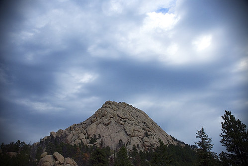
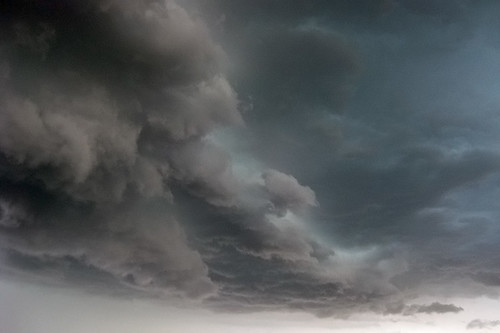
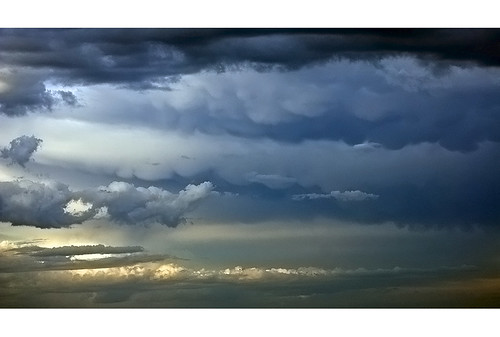
After all of the weekends spent with family, Mark and I had one day left of Memorial Day weekend to get in a little climbing. The summer monsoon was back with a vengeance, so we opted to head out early and try to tick a few routes at the Palace in the Poudre Canyon.

We stopped for sandwhiches in the morning, and then drove the narrow winding road up the canyon. At the first bend, the road snuggles up against the river at the Picnic Rock recreational area. And there, in the middle of the river, was the wildest thing I had ever seen.

Stacked Rocks

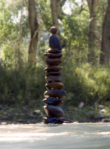
Somebody must have spent hours building this stack of rocks. It was probably 6 feet tall, and made out of beautiful, round, perfectly balanced river rocks. I made Mark stop, and then ran into the river and started taking pictures. I didn’t have my tripod. I didn’t have my ND filter. I had to do a little PS to make the picture look as pretty on the screen here as it did that day. I vowed to come back later with the right equipment and shoot the pillar again.

Mark wades through the deep, fast moving water, this was tricky with a pack on

We drove the rest of the way up to the Palace, now a little later arriving than we had hoped. The river was still deep, and flowing quickly. There’s no Tyrolean for this approach, as there are no real trees to hang one from. Plus the river is VERY wide here. Usually, this time of year, the larger rocks in the middle of the river are dry and we can hop from one to the next without getting too wet. Not this year.

Liv started wading out into the river behind us, and quickly lost her footing. We’ve always thought she was part of the 1% of dogs that can’t swim. And as she started being carried away by the swift current that morning, it reinforced the idea. Mark grabbed her as she floated by, and ended up crossing the cold, deep river twice: once carrying the dog, once with his pack.

Mark takes another lap up Monstrocity (10a)

Climbs for the day included

Churchill Rejects (5.9+) – The classic warm-up for the area. I’ve climbed this route cleanly about 15 times on TR. Someday I’ll get around to leading it. Mark had no problem, as usual.

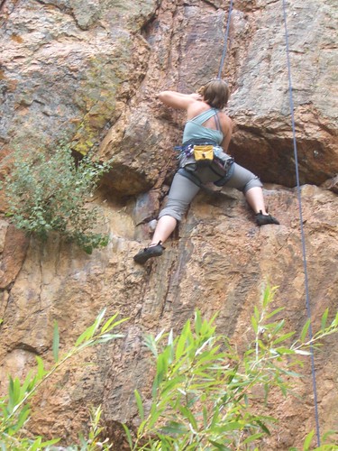
Monstrosity (5.10b) – This was our goal for the day. We figured we’d burn ourselves out fast and be ready to go when the rain arrived at 1p. Mark worked hard for the RP of this huge, long, overhanging route. The holds look good, but they’re all ledges, not positive at all. Doug and Liz showed up as Mark was about halfway up, and helped cheer him on the rest of the way.

I threw myself at this route, and had a miserable performance. Ok, so, I like cracks and slabs! I, evidently, really suck at huge, overhanging routes. I got stuck in the first roof, and despite throwing everything I had at the climb, couldn’t get any further. I lowered off and let Doug clean the route.

Believe it or not, this guy is a serious liberal

For Doug’s first climb of the day, he attacked Monstrosity. He monkey’d his way up the climb, making it look much easier than I just had. He cleaned the route, and got about half-way down on rappel when we all noticed that he had left a few directional draws on the route. There was no safe way to retrieve them other than to climb the route again. The anchors are big and solid on that route, so Mark took another lap on TR, and picked up the draws. This time, he made the route look fluid, easy and fun. Jerk.

The Ogre (5.10a) – I think we’ve been to the Palace more than 20 times over the last few years. And probably 80% of those trips have included doing this climb. Despite Mark’s ultra-workout on Monstrosity, he lead up this climb cleanly to finish the day. Liz and I worked the route and eventually found our own way up. I found that I also am no good at overhanging crimp-fests. Perhaps I should boulder more? Doug campused the first crimpy moves and flashed this route on TR. He cleaned it and rapped down with all of the gear this time.

Shameless photo stealing from Doug and Liz (who also took pictures that day):

The day was late, and we had to ford the river carrying packs and dogs to get home. Everybody accept Liz ended up taking a dunk on this trip. Liv got so frustrated with Mark slipping and dunking her under water that she escaped his reach, jumped from submerged rock to submerged rock for a while, and then, eventually, SWAM across the river! It was incredible. I’ve never seen her so calmly navigate deep, rushing water. Heck of a dog.

On our trip home, we saw the stack of rocks was gone.

Hiking the Ute Trail in RMNP

August 30, 2008 at 8:36 pm

My parents and little brother were in town for the first few days of the long weekend, so we head another excuse to spend time hiking in the mountains! This time, we drove up high in the Rocky Mountain National Park, and ended up hiking several miles down the Ute Trail.

Our hike on the Ute Trail on a Topo map
Our hike on the Ute Trail elevation profile

There’s nice pictures from the day in the gallery.

The trail does not gain or loose too much altitude. But it starts high and stays high. We parked our car at around 11,450ft, and started walking up the gradual slope from there. It’s amazing what a difference a few thousand feet can make in your hiking, even for Mark and I who are getting a little more used to these altitudes. It felt like we had all suddenly gained about 50 lbs to carry up this hill.

Dad and Kevin hiking at 11,500ft

The views along the trail were fantastic, and, miracle of miracles, the trail was quiet. We had found one of the most beautiful places in the park, and saw only a handful of other people near the trailhead. Once we were around the corner and on the true ridge, we were alone with the wind, the mountains, the marmots and the sky.

Long's Peak panorama

Mom, Dad and Kevin turned around at the high point of the trail, after enjoying 360-degree views of the highest peaks in the national park and of Estes Park. It felt like we were standing eye-to-eye with Long’s Peak, and we could see out over the Neversummer range to the western slope. Mark and I picked up the pace and cruised down the last half mile to Timberline Pass, where we took a bunch of pictures and then turned around.

Rocky Mountains

Looking west towards the Never Summer Mountains

The Ute trail actually goes through a large part of the national park, and could be hiked all the way from Trail Ridge road down to Beaver Meadows, over six miles further. The sign at the trailhead told us that the trail we were walking on and trailridge road were built on the trails used by the Ute Indians, hundreds of years ago, as they migrated from winter to summer camps. I think the idea of a migratory life, being able to move from place to place in the Rockies as the weather changed and the plants and animals move, sounds wonderful. Though, I don’t know how well I’d do carrying a baby and all of my belongings over this 11,500ft ridge.

By the end of the day, we were all pretty tired, even without participating in a mass migration. Kevin drove us back down the mountain, and we had a great dinner at Ed’s. Another great hike everybody!

The Boundary Layer is Cool!

August 27, 2008 at 11:36 am

It’s fall and back-to-school time! Due to the completion of my master’s thesis last winter, and teaching at Colorado College last spring, I haven’t actually taken any classes in over a year. And it’s been about two years since I took a class for … (dun-dun-dun) … a grade!


Image from Nasa Visible Earth

So, this fall, I’m taking a class called The Atmospheric Boundary Layer, where we’ll spend 16 weeks learning about that thin layer of air that lays between the surface and the rest of the sky above us.

I have had one day of class, and so far, I’m really excited about this class. I’ve known the basics of boundary layer (BL) dynamics for a while, but it will be nice to get an in-depth view. This is a part of the atmosphere that is full of turbulence. It is the part where dust and pollution is swept up, or trapped down inside. It is a place where all of the rules that we’ve learned about planetary flows (geostrophy, rossby numbers, two-dimensional kinetic energy dissipation, etc) don’t necessarily apply, or apply differently. It is the place where all weather essentially comes from, and the thin layer of air that we, as humans, experience daily.


Image from Nasa Visible Earth

On the first day of classes, the prof got us all jazzed up by looking at a series of pictures showing the importance of boundary layer processes, and in the course of this, he quickly explained something that has been beautiful and mysterious to me about the sky. When I fly, I often see clouds forming in the early afternoon. They almost always seem to form on a kind of grid, with long rows of clouds stretching out to the horizon like those in the pictures here. These are, I now know, called cloud streets, and they are formed when three dimensional convection (think warm moist air rising, forming a cloud, and cooler dry air sinking around it) is organized by the large-scale wind above the BL. So, effectively, you are seeing that thin line where the air which is mixed up by the surface is meeting the smooth flowing air above it. And the clouds all line up.

So, getting back to classes is fun. Learning is something I will never stop loving. And the sky is a beautiful and amazing thing.

Storms Passing

Hiking Greyrock with the Calders

August 23, 2008 at 9:41 pm

Two fortuitous events unfolded last Friday. The first: Mark’s parents and brother arrived in Fort Collins to spend the weekend with us! The second: REI began their Labor Day Sale, and marked down their Garmin Colorado GPS Units 25% off! Despite the load of lack luster reviews on the interwebs, I went and played with the selection at REI and ended up buying a 400t. This is really fun, because the GPS that Mark bought for me, oh so many years ago, officially stopped being able to find satellites or stay on for more than 20 minutes about two years ago. We do just fine with maps and guidebooks, generally, but a GPS makes looking at your hiking stats so much better!

Our GPS track in Google Earth

The elevation profile of our hike (approximately)

So, on Saturday, we took our new toy and our family and headed out for the classic hike up to Greyrock Mountain, just northwest of Fort Collins. We arrived about mid-morning, and took a leisurely pace up the canyon, enjoying the sun and the mountains.

There’s more pictures in the gallery!

Jeff is enjoying the mounains

Kathy and Bruce enjoy a quick break

Unfortunately, bad weather started to roll in approximately 1.92 miles into the hike. Mark, Bruce, Jeff and I all sprinted the last 0.2 miles to the trail junction below Greyrock. We got in our obligatory photos of the mountain and then turned around and headed down.

We got a bit of rain and wind on our way down, but nothing too bad. As usual, the hike out was much faster than the hike up. Everybody was happy to make it back to the car at the end of the day, and we celebrated with tasty ice cream in Old Town. Nice hike everybody!

Classical Greyrock

August Garden Update

August 19, 2008 at 10:56 am

Well, I’ve been wanting to write this post for a while, but I haven’t gotten around to taking more pictures of the gardens.

Sunrise on a foggy morning in the big garden

Let’s start, though, with some other gardens in the area. As mentioned previously, we’ve had some pretty epic weather in the past week. This morning, we got the bad news from our CSA (Grant Family Farms).

In their words:

Last Thursday night at 4:30 in the afternoon our (yours) farm took a violent blow from the sky. Much of the farm was barraged by a 25 minute hail storm. The ground was white in some places and the drifts still present the next morning. In the following 2 days we received over 4 ½” of rain. As of August 1st we had only received 3.8″ all year. We were set to begin harvest this week on beautiful peppers, tomatoes and cucumbers……..as you will see in some pictures coming…….these plants were destroyed. The current lettuce, chards, kales, tomato, pepper, eggplant, edamame, melons and parsley fields were also all destroyed.

The aftermath at Grant Family Farms

Every time we’ve signed up for a CSA, we’ve been made aware of the risks. You shell out $400 in April, and hope to receive a huge pile of food every week for 22 weeks. But there is no guarantee. The farm is organic, and anything can happen. This year has been good so far. A lot of lettuce. The squash and tomatoes and peppers seem to be late coming. And now, they seem to be not coming at all.

Not only did Liz loose her garden, but fully two-thirds of the huge Grant Family farm was destroyed in 25 minutes of blinding, pounding hail. I expect farms to falter in drought, or floods. But you never expect a half hour of bad weather to wipe out everything you’ve been working and hoping for all year.

We talked to some farmers at the Market on Saturday, who were all stony faced in the rain. “This is the last harvest we’ll have at market for the year,” one farmer told me. “Everything else is gone. At least my truck is ok.”

Liz's garden is in sad shape

My gardens managed to escape much damage. The tomatoes (which are finally starting to turn red) are all protected by the eves of my house, but I’m starting to see some splitting after the huge amount of rain we got this weekend. We are still expecting a tomato harvest of epic proportions at the Calder house!

A bigger issue is the plague of grasshoppers.

I’d love to get a photo of these huge (4″ long!) hoppers soon, but they move fast and seem to be able to sense my approach. I can see them eating away happily from inside the house, but when I get out to the garden, they’ve all hopped off into the bushes.

So far, soapy water and bleach have not made a dent in their appetites. I’ve tried a Grasshopper Relocation Program where I capture the bugs and release them directly below my distant neighbor’s bird feeders. This doesn’t seem to stop them. I’m now catching them and drowning them in vodka. This seems to work quickly, but is not a preventative from more of them jumping out of the prairie in front of my house and attacking my plants.

So far, I’ve lost all of my bean plants and a good chunk of my orange tree to the ugly beasts. I’ve been doing research and haven’t found any good advise on how to manage the pests. Has anybody out there discovered a decent way to get rid of a swarm of grasshoppers?

I’m thinking about getting some garden snakes, but Mark really doesn’t like that idea.

Walking Through the Fog

Big Big Storms

August 17, 2008 at 4:56 pm

It’s finally starting to dry out a bit here. I took advantage of the wet weekend and spent two days stocking up the freezer with fresh farm food from our CSA and markets around the area. I’ll be happy right now if I never see another summer squash.

Wall Cloud

Last Thursday, I was dropping off food at D-Liz’s house when the NWS came over the radio and declared a severe thunderstorm warning for our area. This was pretty obvious, because the clouds heading my way were huge, dark, swirling, ominous walls of doom.

There’s pictures in the gallery.

The wall cloud spins above me

It hailed for a good 20 minutes at Liz’s place. We sat and watched the little ice bullets shoot out of the sky and destroy her garden.

The hail lasted for almost half an hour. It accumulated in drifts nearly six inches deep in Liz’s back yard and around my tires. All of the leaves were stripped off of her lovely garden plants and splattered on the fence surrounding. It was the bad start to three days of steady summer rain. Ah, August.

The tomato plant is in really bad shape