Another reason to love the weather out here
From the local NWS web page about the storms hitting our area on Saturday, March 24th:
“While the Denver/Boulder Forecast Office was concentrating on the snow warnings, advisories, and the snow conditions for the foothills and the mountains west of Denver, suddenly severe thunderstorms with multi-vortex tornadoes developed over Philipps and Sedgwick counties. Although the tornadoes were short lived and were generally weak, they skipped around the area causing alarm for the residents of the 2 counties.”
High Winds
Ok, well, my forecast this morning BOMBED. BIG TIME.
I thought the chinook winds today were going to keep the skies clear and help the snow melt, but that didn’t happen. Instead, the storm moved east of us, and a little back-door cold-front brought another couple inches of snow to the Front Range.
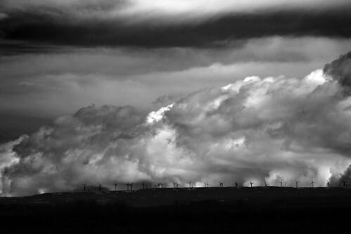
I was angry at the snow this afternoon, so I took off for a little storm chasing. This shot was taken out north-east of Ault this evening. The windmills are actually in Wyoming, part of the Wyoming Wind Project. We are lucky to be able to pay a little more and buy wind power from the local electric utility. I think it’s interesting that many of these windmills weren’t running on a day like today when the wind was blowing at more than 50mph. Actually, when the wind blows too hard, the blades lock down for the safety of the machinery. Pretty cool deal.
Snow Eaters!!
Well, as much as the last post glorifies the mountain powder surrounding us, the hard-packed left over snow (that’s nearly a record-setting ground cover) that has been covering Fort Collins all winter has not been as much fun to play in. Today, I think we’re beginning to see the real end. Today, we have a real, serious, Chinook!
I’m not going to go into the dynamics of the whole situation, if you want to learn more about down-slope wind events, wikipedia has a nice entry. It’s enough to say, the winds are gusting at almost 70mph, the temperature rose 35 degrees over night, and the humidity is down to a nice, snow melting, 30%.
We’re supposed to have it all day long! I’ll update with more stats tonight.
Pictures of the 1913 Denver Snow Storm
Ok, I just saw this and I love it! According to our local office of the National Weather Service:
“The greatest snow storm in Denver weather history occurred during December 1st through December 6th of 1913. The bulk of the snowfall occurred on December 4th and 5th. 45.7 inches was recorded for the entire snow event. This kind of brings our last several snow storms into prospective! ”
Definitely check out the great (and very funny) pictures from the storm that they have posted here: http://www.crh.noaa.gov/bou/?n=1913_denver_winter_storm
Closing in…
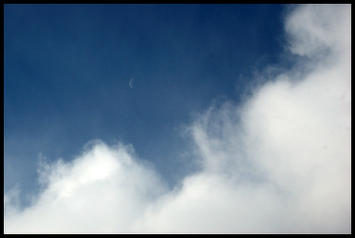
While St. Louis is getting a heck of an ice storm, we’ve gotten another couple inches of snow in the last day or so. It would be nice if we could get back to our usual sunny and dry weather for a typical January. I doubt that’s going to happen any time soon though. This is a shot I took of the moon yesterday, just before it was swallowed up by these thick snow storm clouds.
More Impending Doom!
So, I think the models missed this one by quite a bit. Until this afternoon, the temperatures below this cold front weren’t supposed to get below freezing. It was just going to be a heavy rain event. Well, now, as you can see below, the NWS forecasters in St. Louis are calling for a “crippling Ice Storm” and CNN is predicting it is “threatening chaos”.
Well, whatever it turns out to be, I have enlisted the help of a guest Blogger On The Scene, Kevin T, to help bring you the story as it unfolds! Check back for more reports!

