Climbing Batman and Robin

July 25, 2009 at 8:56 pm

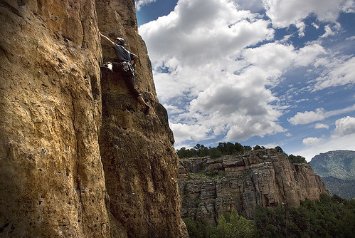
No, not climbing AS Batman and Robin (which would be awesome) or climbing WITH Batman and Robin (even awesomer!) Batman and Robin is a classic little moderate on the Batman Pinnacle in Lumpy Ridge. When Mark and I were talking about moving to Colorado, five years ago, I looked up “local” climbing for Fort Collins, and found the ClimbingBoulder (yes, I’m old) page for Lumpy Ridge. I was in awe. And the first climb I wanted to do was Batman and Robin.

It took us five years to get around to it.

Looking out at Lumpy Ridge, Batman Rock and Batman Pinnacle

There’s more photos from the day in the gallery.

Its been a little bit of a different summer for Mark and I. He hasn’t been feeling as strong, so we’re not climbing hard trad or pushing our limits on long routes. It’s nearly the end of July, and we haven’t stepped foot on Lumpy yet this year. We wanted to go back, but didn’t feel up to an epic day. What to do? How about a 4 pitch 5.6 that used to inspire you? Once upon a time…

We got up relatively early, in hopes of avoiding crowds and weather. The sky was intermittently filled with clouds and blue sky. When we parked, a cold wind blew across the hills, and the dark sky rumbled; we didn’t think we’d get a climb in. But we hiked up the steep hill, and by the time we were wandering lost along the ridge, the sun was shining on us once more.

The continental divide in the morning

Yes, wandering lost along the ridge. Just for a little bit. This rock is in an area we have never explored, so, of course, we spent some time staring up at a rock wall, trying to figure out if this was where we wanted to be climbing. It wasn’t. We had found Checkerboard Rock first, and Batman Pinnacle was further up the hill.

The route itself was quite a lot of fun. The pitches were short, the route finding was pretty easy, and the cracks were very pretty and very fun to climb.

The fantastic handcrack on the third pitch

As we buzzed our way up the four moderate pitches, the sky darkened again. This time, real storms formed to our south, obscuring Long’s Peak. As we topped out on the lovely little summit, the sky was filled with heavy grey clouds and thunder rolled out of the blackness to our south.

Kate on the summit of the pinnacle

So, we didn’t get to spend much time on top of the pinnacle. Which is too bad, because, really, why else climb a detached pillar of rock than to jump around and take fun pictures on the tiny summit? I took a few shots of the valley and then rain started, so we set up our rappel and headed down.

On Batman Pinnacle

The rap off of Batman Pinnacle was short. We actually rapped too far down the hill, and had to scramble back up quite a ways to find the trail that goes along the bottom of Batman Rock. For others interested in climbing this route, just rap to the base of the big tree, then walk off to the east.

In the end, it was a quintessential fun Lumpy Ridge adventure. We had a long, hard, uphill hike. Got a little lost. Eventually found the climb. Four easy, fun, pitches of climbing. Got a little lost on the descent. Eventually found our way down, and hiked out in the rain. We’ve done it before, and we’ll happily do it again.

Darker skies, thicker clouds

Sunflowers

July 22, 2009 at 5:04 pm

Sunflowers

The field next to my office is filled with wild sunflowers. It is quite beautiful, and one of my favorite parts of summer in Colorado.

Climbing Mt Sherman (14,036 ft)

July 18, 2009 at 6:20 pm

Mark and I totally mooched along with plans from a group of transplanted Michiganders for a hike up our 7th Colorado 14er (a 14,000ft+ tall mountain) last weekend. Doug and Liz’s friends Brian and Sarah recently bought a condo in Silverthorn, and were kind enough to let us crash on their floor Friday night. Saturday morning, the nine of us in this group got up at 5am, packed into two cars, and drove south for an hour to the Fourmile Creek trailhead for a summit attempt on Mt. Sherman.

Mt Sherman is visible from where we park the cars

Mt Sherman is considered one of the easiest 14ers in Colorado. The round-trip hike is estimated to take a little over 5 miles, and has only 2,000ft of elevation gain. Most of the trail follows an old mining road. Only the final bit of climbing to the summit ridge presents any difficulty, where you have to scramble through some rocks on a relatively thin ridge-line. But we never felt like we were in any danger.

We left the car at around 8am, and arrived at the summit at around 10:30a. Even though the route was “easy,” I was still huffing and puffing on the steep sections, and stopping to take plenty of “photo breaks.”

Old Mine Equipment

There’s more photos from the day in the gallery.

Being one of the easier big-mountain climbs in our state, Mt. Sherman is rightly popular. And we saw huge numbers of people in the long line up to the summit. There were kids, and older people, hard-core mountain runners, lots of dogs, church summer camps, and big families. I know people often complain about the crowds on Colorado’s 14ers, and they’re not exaggerating. But Mark and I spend enough time at remote trad crags and back country campsites, that I’ve started to really appreciate an outdoor crowd. Sometimes an adventure isn’t just about getting to the top, or seeing the best view, but also about the people you meet and the friends you make along the way.

Hooray! We climbed another big mountain!

The gang hung out on the summit for about an hour. We took a lot of pictures, ate lunch, enjoyed the sunshine, and partied with the crowd on the summit. Mark and I were the only ones in the group to sign the summit register, but it’s one of my favorite parts of climbing a big mountain, so I gotta do it. The battery on my camera went dead just after our summit photo, so no pictures on the way down!

Enjoying the summit

We looked at the map, and discussed plans for further hiking. Two in our group decided to head down, and the rest of us hiked over to Gemini Peak, a 13’er just east of Mt Sherman. Mark and I walked up to the base of the steep cone of rotten-looking rock, and decided the last 100ft of wind-blown creepy-looking climbing might not be worth the trouble. As the rest of the group worked their way up the pile of rocks, we headed back towards the car.

Rather than hiking back over the summit of Sherman, we consulted our maps and decided to try to cross-country hike over the White Ridge and down on a direct line back to the cars. We took it slowly, approaching each new change in grade of the ridge with care, making sure the path ahead was passable before attempting further decent.

The views are amazing on all sides

As the hill side really began to get steep, we started following a small creek, and found a trail carved into the side of the hill next to the drainage. Woo hoo! We followed this small, loose, wavering trail down the hill for quite a while, until it ended in a wide snow field.

Mark and I do a good bit of rock climbing. But we’ve never owned ice axes and have never done any snow climbing, ever, before. In fact, in our world, snow is to be avoided at all costs. But Mark was enjoying the sunny day, and we found that you could do some nice ski-type sliding on this gently sloping snow field.

The next snow field was steeper. Mark took his “skiing” up a notch, and was basically in full-flight standing glissade (a mountaineering term for “sliding down a snow field”) until he lost his balance and landed in a splash of soft, wet snow. I walked around.

The third snow field was wider and steeper still. This time, Mark’s standing glissade was nicely balanced, and I decided to do the whole thing in a sit-glissade. I slid down the 50ft snowfield on my butt, and had a fabulous time!

There were probably 4 or 5 more snow fields on the descent. We attacked each one with glee, alternating between standing and sliding on our bottoms. We had SOOOO much fun. We threw ourselves down these slippery slopes with such energy and enthusiasm, that we were down at the cars before we even realized it. We checked our watches and found that we had descended most of the mountain, the last 1500ft or so, in less than 25 minutes! And done it all sliding on the dirty snowfields left in the middle of July. It was so much fun!

We were the first ones back to the cars, but only waited for maybe 15 minutes before the other 5 hikers (who climbed Gemini Peak) came sliding down the same drainage we had been on. They had followed our foot prints, foot slides, and butt prints all the way down the side of the mountain. The two who had started their descent first were the last to arrive at the car.
It was a great day, and we had a lot of fun with everybody. I really hope we have a chance to hike, and maybe slide, with everybody again!

Climbing Lilly Lake

July 11, 2009 at 8:50 pm

It’s definitely summer. The monsoon has broken for a few weeks, the skies are beautiful and blue, the garden is growing like gang-busters, and we’re out trying to climb every rock we can. Which, unfortunately, doesn’t leave a lot of time for writing blogs.

After reading Doug’s update from the past two weekends this morning, I decided two things. 1, I better hurry up and write. And 2, I should let everybody know a little secrete. I keep most of our photos in the gallery here on the site, only putting a sampling of my favorites on our Flickr site. So, if you want to see all the new pictures as they come out Subscribe to the RSS feed for our photo gallery. It’s pretty cool. I recommend it.

Liz, Doug, Jo and Mark hike along the wide sidewalk towards the rocks

So, after our fun weekend of clippy-clippy sport routes in Shelf Road, we thought we’d enjoy some more, at a slightly more comfortable altitude. On this Saturday adventure, Mark and I met Doug, Liz and Jo in Loveland, and we all drove up to the Lilly Lake area of Rocky Mountain National Park.

The rocks crowning this hillside are known as The Jurassic Park crags, and they have seen a lot of recent bolting and development – in a good way. Our guidebooks were all completely out of date, and I printed a basic topo off from Mountain Project, but there was still plenty of information missing.

If you do head up to this area, and I highly recommend it, I also recommend (1) spending time printing out information from MP.com, or (2) going with somebody who really knows the area, or (3) having a great sense of adventure. On Saturday, we went for option 3.

Jo climbing in the mountains

Jurrassic Park has been a sport-climbing area of Rocky Mountain for a long time, development began back in the late 80s by Estes Park locals. The approach is relatively mild, beginning on a flat sidewalk on the edge of beautiful Lilly Lake, and then hiking straight up the side of the mountain to the bottom of the rocks.

Since I’m not feeling particularly wordy right now, I’ll just made some brief notes on the climbs we did.

There’s more photos from the day in the gallery.

Mark on the Slab

Coloradoddity (5.6) – In an effort to continue my happy good-feeling leads of the last few weeks, I hopped on the sharp end for this one. It is a surprisingly long route, and thinner and more insecure in some sections than I expected for a 5.6 sport climb. But lots of fun.

Stout Blue Vein (5.8) – Doug led this route, just to the right of mine, while I was on Coloradoddity. He was surprised by the thin, tricky moves at the crux traverse between the 2nd and 3rd bolts, but pulled through and finished the climb cleanly. We all took a lap on it, but Mark and Doug were the only ones to have a clean ascent. I swore loudly after falling just PAST the crux (grrr), and the slide down the slab delaminated the sole of my right shoe. Crap.

Liz belays amoung the flowers

T-Rect (5.7+ R) – Mark led this one in the late afternoon, and I thought it was a great example of how well thought-out development in this area has been. The “R-rating” was because of a run-out between the 2nd and 3rd bolt, which might be a little scary, but wasn’t hard. The run-out is there because there is a beautiful horizontal crack that takes great gear (Red Camalot). So, if you remember you’re in the mountains of Colorado, and bring a few cams, even to a sport area, this route is definitely not R.

Critical Morass (5.10d) – Doug re-climbed his 5.8 lead, and then past the anchors to set a top-rope on this one. We all took a turn on it, and had a great time. The route had two thin, tricky cruxes one at the crack on the steep slab, and one at the top pulling over a bulge with a thin finger crack. It was definitely the best climb of the day, and we all really enjoyed it. Even those of us with no rubber on our right shoe.

Chasing the Shade: Climbing Shelf Road in July (Part 2)

July 4, 2009 at 8:04 pm

If you haven’t read Liz’s recap of the weekend (Part 1 and Part 2), you should go do that. I’ll wait here.

Ok, we’re back together now?

Saturday morning, July 4th, at Shelf Road in the desert of Southern Colorado. It’s hot. The gnats have started to come swarming back. Our newly purchased bug spray (various amounts of DEET in various kinds of spray canisters) seems to be completely worthless in these swarms. The best thing we found was an old Buzz-Away Extreme(!) wipe in Liz’s backpack. The combination of citronella, tea-tree, and geranium oils was far more potent than anything sold at Wallyworld. If you run across these products this summer, I recommend them. BUY!

We cooked breakfast and talked about our plans for the day. Somehow, Mark managed to drop his french press full of hot coffee all over his foot. The nearly-boiling water filled his tennis-shoe and blistered the top of his foot within minutes. It wasn’t pretty.

Mark's hacked together footwear after pouring hot coffee all over his foot

We decided to head to the Dark Side. We walked all along the base of the cliff, only to discover the whole wall was bathed in oppressive sunlight, and didn’t look to be heading into shade any time soon. In fact, at 10:30a on a July morning, Cactus Cliffs, that wonderful outpost of warm, sun-filled winter climbing, was in deep shade. The dark, sunless walls of Cactus Cliffs beckoned us from across the wide valley, so we turned around, back-tracked about half a mile, and then walked another mile for the shade.

We all managed to get in ascents of Beach Ball (5.8), and we decided that it is a sandbag. The overhanging fist crack at the top felt harder than the 5.10 from the previous day. A heck of a warm-up. Mark felt antsy about the building clouds to our west, so he hopped on a lead of Third Stage (5.10b/c) around the corner. This long, thin, beautiful black slab is one of my favorite routes at Shelf, but it is tricky, painful, and a scary lead. Especially with thunder rolling in and dark clouds blotting out the desert sun.

By the time Mark finished the lead, the sky was dark, and rain was imminent. He cleaned the climb, and we all packed up. It was disappointing, to say the least, to have a day so full of bad luck. Burned feet, hot cliffs, long approaches, sand bagged routes, and then walking out in a storm at 2pm. We didn’t want to give up, though. And when we got down to the old Cactus Cliffs trailhead, we saw the best option for salvaging the day.

Yep, the new pit toilette that sits between Cactus Cliffs and the Vault turned out the be the perfect shelter from the incoming storm. We relaxed on the concrete floor, as cool wind and rain sprinkled down, and lighting flashed overhead. We watched the few hearty souls out climbing with us walk past our shelter in the rain, complaining about the bugs and the weather, and throwing in the towel for the weekend.

It didn’t take long for the storm to pass by, and the high clouds lingered, covering the sun and cooling the cliffs around us. After Mark’s two hard leads on a burnt foot, I declared him done leading for the day, and that it was time for us to enjoy more easy “clippy-clippy” sport climbs.

We found Crynoid Corner (5.7) was in it’s own little pocket of shade by this time. This is one of our favorite warm-ups, and while I have pink-pointed the climb before (led on other people’s gear), I’ve never red-pointed it. So, I grabbed our rack of quickdraws, tied on a rope and headed up!

The lead felt surprisingly good. Mark and Liz followed and enjoyed the climb, and I was so jazzed that I wanted another serving. There is a little, out-of-the-way climb along the hike back to the Bank that I have never found any information on. I’ve been enjoying it for years now, nick-naming it “Kate’s Favorite Lead,” and it’s probably a 5.7 as well. Shorter than Crynoid Corner by half, the route follows a black slap up the right side of a little alcove about 200ft right of the 2150 Wall.

I led it happily. Liz led it beautifully. Mark cleaned it without any complaint. It was a great cherry to place on top of a great weekend, and left us feeling that the day was actually a very good one!

Cooking dinner Saturday night.  Check out the sweet tarp set up, for shade and rain protection!

Dinner was suggested by @lstefurak on Twitter Thursday, when I asked for ideas for new camp food as I wandered lost through the grocery store. Luke said:

Take onions & caramelize w/ brown sugar. Next add beer (Honey Brown), add sausage + heat and serve on toasted hoagies. 1 pot meal!

I thought that sounded good, but I had no idea how good it was really going to be. It was SO TASTY! Luke’s camp dinner wins! I wish I had a prize I could give out, because it was fantastic. To thank him for his help, all I have is gushing words, and perhaps a link to his very awesome blog. Thanks Luke!!

That night, the campground was deserted. We heard a few fireworks in the far distance, but mostly we enjoyed the still quiet night and having Shelf Road entirely to ourselves. The next morning, we packed up in the eerie quiet of the hot, summer desert and headed home to the Fort.

It was a nice trip, and we learned a lot. We learned that Citronella works better than DEET on gnats. We learned that Kate and Liz are both strong, capable leaders. We learned that awesome camp dinners can be had with one pot and 140 characters. And we learned that Shelf Road is totally climb-able in the summer, especially if you chase the shade.

Chasing the Shade: Climbing Shelf Road in July (Part I)

July 3, 2009 at 7:25 pm

Over the long 4th of July weekend, we were lucky enough to get Liz to come out and play with us. We discussed different options for the trip, and eventually decided on Shelf Road.

There’s a few nice photos from the weekend in the gallery.

Mark climbing at Shelf Road

The lovely, vertical, limestone walls of the Shelf Road canyon have drawn our attention many times before. The area sits high in the desert of southern Colorado, and provides beautiful warmth on sunny walls, even in the depths of winter. In the summer, however, the canyon becomes a pink limestone oven, with heat radiating from all walls. We didn’t care. We wanted clippy-clippy sport climbs and starry desert nights.

We left Thursday, after work, and found a nice campsite at the Bank campground that night. Friday, we decided to head over to the Vault. This is a cliff-line where we tried to climb in March last year, but it was too shady and cold at the time. In July, the shady, north-east facing walls of the Vault would be welcome.

To start the morning, though, I wanted to do a fun easy lead. Liz and I both led up Awethu (5.6), a very easy climb up a shallow dihedral. We had fun on the simple, very overly protected, route. We moved right one after this fun warm-up, and climbed Forty Two and no Rinkhals (5.9+). This shallow dihedral was tricky, steep, thin and a lot of fun.

Mark clips the bolt

By this time, the bugs were really starting to swarm. When we’re at Shelf in the spring and fall, the wasps and bees can be scary, but in a rainy July, the gnats are king of the Shelf Road bugs. They swarmed around our heads, dive-bombing our eyes and ears. Liz and I found a new use for our Buffs: covering ears and face to keep the swarming gnats off.

We moved into deeper shade and all took a trip up Chip Off the Block (5.9). I really love this airy route up a blocky arrete. We finished up the day with Fire It Up (5.10a/b). This route climbs a fairly wide, pretty dirty, hand crack, and then traverses left in a thin and kind of nerve-wrecking move around the corner to the left. The route finishes on a steep thin-hands crack up bone-hard black limestone that would have been a really beautiful if I hadn’t been so exhausted.

Liz on Fire It Up (5.10a/b)

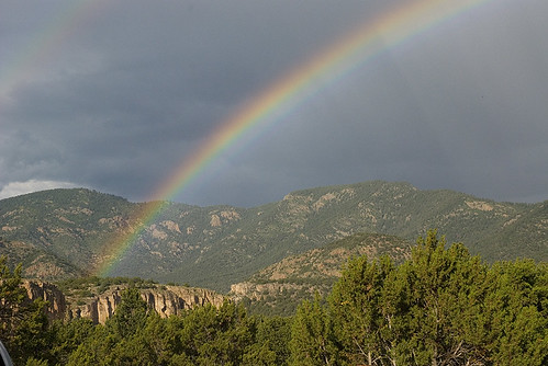
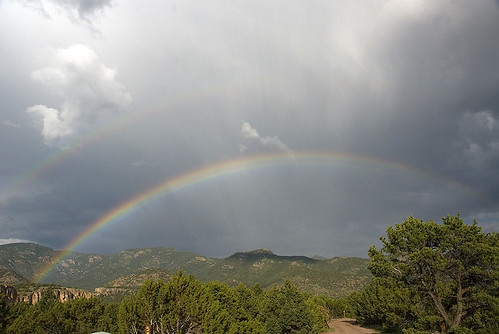
We hiked back to camp in the late afternoon, with clouds gathering on the horizon. We took a quick (relatively) trip back to Wallyworld in Cañon City for bug spray and paper towels. We waited out the rain sprinkling over camp when we got back. An amazing rainbow graced our desert valley after the storm moved off to the east, and I took about a bajillion pictures of it.

The End of the Rainbow

We made tasty fajitas for dinner, and finished off a great day with a big campfire. As darkness fell over the desert, we watched cliff swallows hurdle through the trees chasing bugs, and bats swarming out of limestone caves looking for dinner.

Rainbow Over Shelf Road

Dylan and Ann’s CDT Send-off

July 1, 2009 at 3:17 pm

Wow, I am way behind on blog posts right now. I suppose it’s a good thing to be doing more stuff this summer than spending time writing about it.

The Sun Peaks Through

Last week, Dylan and Ann started their month long walk across the Continental Divide Trail (CDT) in Wyoming. They left from the boarder of Colorado and Wyoming on the morning of July 1st, and hope to be crossing the boarder of Wyoming and Idaho, about 550 miles of trail later, on the 29th. How crazy and awesome is that?!

Dylan is a great blogger, and will be posting maps and details of their epic hike on his blog. I highly recommend checking it out.

Happy hikers excited to start their adventure!

As the start of their trail was essentially “in my neighborhood,” and I haven’t seen Dylan and Ann in months, I took a few days off of work and drove up to see them off. Mark couldn’t get any extra vacation, so I did this trip on my own, which made it extra adventurous for me. I don’t travel by myself very much, so the three hour trip across empty, wild, Wyoming, and a night of sleeping in a tent by myself, were a novel and welcome experience.

I felt inspired to make some nice photography on this trip, so be sure to check out the gallery page.

Clear Calm Morning

The CDT crosses the boarder of Colorado into Wyoming just south of Encampment, WY, which is a quiet, beautiful, mountainous area that I have never visited. When I arrived on Tuesday afternoon, most of the group had gone out to kayak and swim in Hog Park Reservoir, a beautiful mountain lake just off the boarder. We stayed at Bottle Creek Campground, where we were the only campers.

The area has been hit hard by bark beetles. I’ve never seen a forest so brown with dead trees in my life. Certainly more than half of the trees, across large swaths of the forest, were orange-brown and crispy. It looked a bit like a fall view, until you remember that these are evergreen trees, and your heart sinks.

Southern Wyoming, and a lot of beetle kill

Dylan and Ann and their friend Pete were all ready for their long hike. We hung out Tuesday night, talked logistics and plans, played with cool new ultra-light gear, discussed the trail over the first week and the tasty Thai restaurant in Rawlins, WY. On Wednesday morning, we roused at 6am, and were on the road towards the boarder before 7a. The 30 miles of dirt road to the boarder took about an hour to drive, and the happy, hardcore hikers got on the trail around 8:30a on the morning of July 1st! Bon Voyage, mes amis!

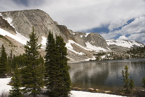
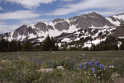
The Snowies

After they walked off into the mountains, I rode back to the campground with Ann’s wonderful parents, talking about tropical meteorology the whole way, and then started on my way home. This time, instead of driving across the wide open plains on I-80, I decided to take WY-130 through the Snowy Range on my way home. This turned out to be a great decision.

Wildflowers in the Snowies

This little road drives right over the crest of the Snowy Range, a beautiful group of mountains just west of Laramie. The road tops out near 11,000ft, it’s not quite as high as Trail Ridge, but it feels very close. I didn’t get much hiking in, as several parking lots were still filled with 10ft drifts of snow, and several trails were lost under huge drifts, still, on the first day of July.

But I drove over the mountains, I enjoyed the views, I made some photographs, and I vowed to come back.

The Diamond reflected in Mirror Lake

Summer Weekends in Vedauwoo, Part 2

June 28, 2009 at 3:54 pm

The nights seem especially warm and short right now. Sunday, we woke up tired and sore. And determined to find climbs without an approach this time.

So, we climbed at the Nautilus on Sunday.

Wildflowers below the Nautalis

The shady side of the formation was already busy when we rolled in Sunday morning. We started our morning on Straight 4 Ward (5.5). Maybe we were sore, or maybe the rock was rougher on these less popular climbs. Whatever the reason, this crack HURT. My hands screamed as I jammed the sharp, toothy, crystalline crack. It felt harder than 5.5. It hurt more than a 5.5 should.

We swore our way up the warm-up. “Oh, Holy, OW!” “Mother OW!”

It was easy to top rope Par Four (5.8) to the left. This was a very fun crack. Hard, thin, painful. I lost the skin on my left ankle, and my right hand was bleeding when I got down. But I had some lovely finger locks. I used perfect fist jams. It was very fun.

We contemplated another climb, but decided we didn’t have the energy. It felt like Vedauwoo may have won this round. But we’ll be back for more.

The rock took a chunk out of me on Sunday