
Storm Chasing
We did the drive back from St. Louis in one day, leaving my parents’ house at around 6am and getting back to Fort Collins at around 8p. We’ve done this drive before, and while it is long, it’s not too hard. It’s fun to put an audio book on and just cruise across Kansas.

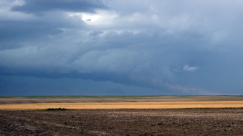
Usually we’re doing the drive on the Sunday after Thanksgiving, or New Year’s Day. We’ve hit ice storms and blizzards along this stretch of I-70 that were powerful and murderous. In July, however, it’s not the snow you have to watch out for. It’s tornadoes.

So, yes, I’m an atmospheric scientist. And I certainly feel sorry for the people who have had losses due to violent storms. But, I can’t help myself. Tornados are cool!
There’s more pictures from the heavy weather on our drive home in the gallery.
We saw storms building in western Kansas, and a quick trip to the NWS website from the iPhone confirmed my suspicions, there was a tornado on the ground to our north. However, there was so much rain, we couldn’t see it.
Later, in Eastern Colorado, I spotted a beautiful, huge, spinning supercell, and Mark stopped so I could get out and take some pictures. And then we drove closer. And took pictures. And then a little closer. And then the storm got closer to us. Standing outside and watching this beautiful, amazing storm was an incredible experience. The wind was blowing so hard I felt like I had to hang on to the car to stay standing. And it was all blowing into the bottom of that wall cloud.

The storm rotated and moved across the plain like a giant hoover, sucking up huge amounts of air. The lift from the updraft in this storm was so intense that a local extreme low pressure was forming below the cloud. That low pressure caused what little moisture that could be found in the hgh plains air to condense into low clouds below the rotating saucer above.
Then it started to hail. So we turned around a high-tailed it back to the interstate. Another check using the iPhone confirmed we were watching a super-cell storm. The national weather service had identified it as a large tornado via Doppler radar. This means that the cloud droplets were definately rotating around the updraft. But we never saw a tornado on the ground for any length of time. So, it’s doubtful that there was an actual tornado on the ground that day.
It was definitely fun to watch, though.