
Hiking Greyrock with the Calders
Two fortuitous events unfolded last Friday. The first: Mark’s parents and brother arrived in Fort Collins to spend the weekend with us! The second: REI began their Labor Day Sale, and marked down their Garmin Colorado GPS Units 25% off! Despite the load of lack luster reviews on the interwebs, I went and played with the selection at REI and ended up buying a 400t. This is really fun, because the GPS that Mark bought for me, oh so many years ago, officially stopped being able to find satellites or stay on for more than 20 minutes about two years ago. We do just fine with maps and guidebooks, generally, but a GPS makes looking at your hiking stats so much better!

")
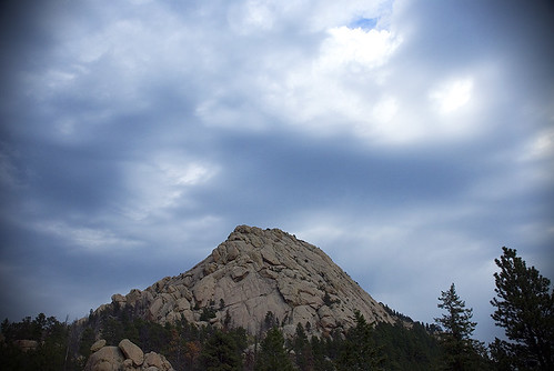
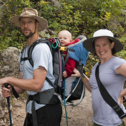
So, on Saturday, we took our new toy and our family and headed out for the classic hike up to Greyrock Mountain, just northwest of Fort Collins. We arrived about mid-morning, and took a leisurely pace up the canyon, enjoying the sun and the mountains.
There’s more pictures in the gallery!


Unfortunately, bad weather started to roll in approximately 1.92 miles into the hike. Mark, Bruce, Jeff and I all sprinted the last 0.2 miles to the trail junction below Greyrock. We got in our obligatory photos of the mountain and then turned around and headed down.
We got a bit of rain and wind on our way down, but nothing too bad. As usual, the hike out was much faster than the hike up. Everybody was happy to make it back to the car at the end of the day, and we celebrated with tasty ice cream in Old Town. Nice hike everybody!
Beautiful pictures as usual. I really liked the close ups of the butterfly. i had a great time this weekend. The concert at the end was an amazing find, as though the stars were aligned to bring us all to that entertaining conclusion.
Mark and Kate,
I just hiked Greyrock and loved it. Does Kate know Nick Guy from the climatology program? If so, please let me know if you all hike together because I am interested in meeting you and learning how to integrate your new GPS device with your blog.
Rob Miller